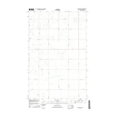
2014 Map of Westhope SE
USGS Topo · Published 2014About this map
The Week Cem sits on a slight rise in this part of Bottineau County, overlooking a landscape defined by its rigid section-line grid and scattered glacial depressions. This 2014 survey captures a rural prairie environment where the human footprint is primarily marked by a methodical network of gravel and section roads like 98th St NW and 18th Ave NW. The terrain is peppered with small, irregular wetlands and intermittent basins, characteristic of the pothole region, while Highway 83 provides the primary north-south corridor through the area. The placement of the cemetery and the precise alignment of boundaries like 100th St NW reflect the long-standing agricultural organization of the North Dakota plains, where family-named landmarks often serve as the primary points of orientation in a sparsely populated landscape.
Find a feature on this map
16 named features on this map. Tap any name to fly to it.
Don’t see what you’re looking for? This feature index may not catch every label — zoom into the map to look around manually.
Map Details
Editions of this 2014 Westhope SE Map
This is the sole edition of this map. No revisions or reprints were ever made.
Other maps of this area

1949 · Maxbass
USGS Topo · 1:24,000

1949 · Eckman
USGS Topo · 1:24,000

1949 · Landa
USGS Topo · 1:24,000

1949 · Westhope SW
USGS Topo · 1:24,000

1949 · Landa SW
USGS Topo · 1:24,000

1950 · Newburg
USGS Topo · 1:24,000

1950 · Westhope SW
USGS Topo · 1:24,000

1950 · Landa
USGS Topo · 1:24,000

1950 · Landa SW
USGS Topo · 1:24,000

1951 · Westhope SE
USGS Topo · 1:24,000