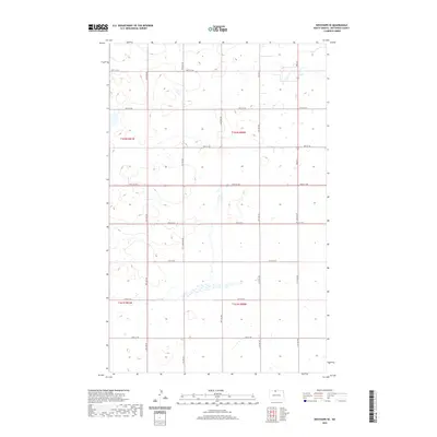
2020 Map of Westhope SE
USGS Topo · Published 2020About this map
North Dakota's northern prairies are defined by the rigid grid of the Public Land Survey System in this 2020 landscape, where section lines and range boundaries dictate the placement of local infrastructure. The terrain is structured by a network of gravel roads including 18th Ave NW and 17th Ave NW, which serve a dispersed agricultural community near the Canadian border. The map illustrates the intersection of several townships, specifically t162n r81w, t162n r80w, t161n r81w, and t161n r80w, highlighting the vast, open nature of Bottineau County. Numerous seasonal wetlands and prairie potholes are scattered across the sections, particularly between 98th St NW and 99th St NW, reflecting the region's post-glacial topography and its importance for local drainage. This documentation is essential for understanding contemporary land ownership and the persistent agrarian layout of the northern plains.
Find a feature on this map
18 named features on this map. Tap any name to fly to it.
Don’t see what you’re looking for? This feature index may not catch every label — zoom into the map to look around manually.
Map Details
Editions of this 2020 Westhope SE Map
This is the sole edition of this map. No revisions or reprints were ever made.
Other maps of this area

1949 · Maxbass
USGS Topo · 1:24,000

1949 · Eckman
USGS Topo · 1:24,000

1949 · Landa
USGS Topo · 1:24,000

1949 · Westhope SW
USGS Topo · 1:24,000

1949 · Landa SW
USGS Topo · 1:24,000

1950 · Newburg
USGS Topo · 1:24,000

1950 · Westhope SW
USGS Topo · 1:24,000

1950 · Landa
USGS Topo · 1:24,000

1950 · Landa SW
USGS Topo · 1:24,000

1951 · Westhope SE
USGS Topo · 1:24,000