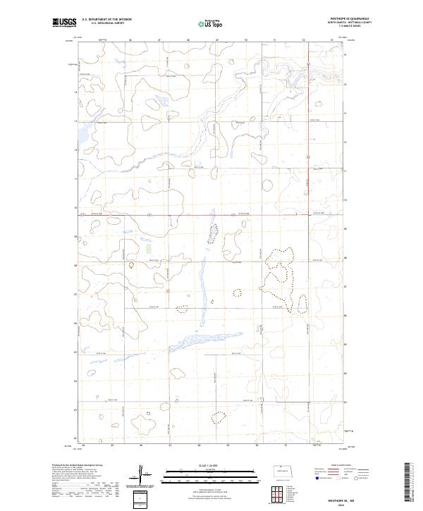
2024 Map of Westhope SE
USGS Topo · Published 2024About this map
The agricultural plains of Bottineau County are defined by a meticulous grid of rural section lines and section numbers in this recent survey. Local transport relies on a network of established routes like 19th Ave NW and 97th St NW, which facilitate movement between the vast prairie tracts of t162n r80w and t161n r81w. The landscape is dotted with numerous small wetlands and basins, characteristic of the region's terminal moraine topography, where seasonal water collects between the rises. While no major townsites are featured on this specific sheet, the preservation of the original Public Land Survey System township and range lines provides a vital framework for genealogists and land researchers tracing property ownership through the Bottineau area. The map illustrates how modern infrastructure, such as 15th Ave NW and 93rd St NW, continues to follow the historic cadastral boundaries established over a century ago.
Find a feature on this map
56 named features on this map. Tap any name to fly to it.
Don’t see what you’re looking for? This feature index may not catch every label — zoom into the map to look around manually.
Map Details
Editions of this 2024 Westhope SE Map
This is the sole edition of this map. No revisions or reprints were ever made.
Other maps of this area

1949 · Maxbass
USGS Topo · 1:24,000

1949 · Eckman
USGS Topo · 1:24,000

1949 · Landa
USGS Topo · 1:24,000

1949 · Westhope SW
USGS Topo · 1:24,000

1949 · Landa SW
USGS Topo · 1:24,000

1950 · Newburg
USGS Topo · 1:24,000

1950 · Westhope SW
USGS Topo · 1:24,000

1950 · Landa
USGS Topo · 1:24,000

1950 · Landa SW
USGS Topo · 1:24,000

1951 · Westhope SE
USGS Topo · 1:24,000