
1950 Map of Westhope SW
USGS Topo · Published 1950About this map
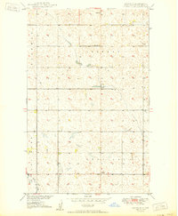
Glacial depressions and prairie potholes dominate this 1950 topography of the North Dakota borderlands. The landscape, surveyed as part of the Department of the Interior program for the development of the Missouri River Basin, reveals a sparsely settled agricultural region organized into township grids. Local education centers like Stinson Sch No 1 and Stinson Sch No 3 served the farming families within Bentinck and Hastings townships. The map records the presence of the Zion Ch in the northern portion of the quadrangle, which along with the schools, formed the social hubs for the community before the consolidation of rural districts. The terrain is characterized by intricate drainage patterns and small water bodies that underscore the high-plains hydrology of the era.
Find a feature on this map
8 named features on this map. Tap any name to fly to it.
Don’t see what you’re looking for? This feature index may not catch every label — zoom into the map to look around manually.
Map Details
Editions of this 1950 Westhope SW Map
This is the sole edition of this map. No revisions or reprints were ever made.
Other maps of this area

1948 · Lansford
USGS Topo · 1:62,500

1949 · Lansford NE
USGS Topo · 1:24,000

1949 · Maxbass
USGS Topo · 1:24,000

1949 · Eckman
USGS Topo · 1:24,000

1949 · Westhope SW
USGS Topo · 1:24,000

1950 · Lansford
USGS Topo · 1:62,500

1950 · Antler
USGS Topo · 1:24,000
1950 · Renville
USGS Topo · 1:24,000

1951 · Westhope SE
USGS Topo · 1:24,000
1951 · Kuroki
USGS Topo · 1:24,000