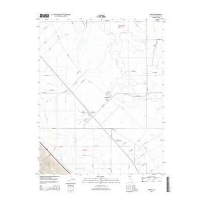
2015 Map of Westley
USGS Topo · Published 2015About this map
The San Joaquin River and Tuolumne River converge in this agricultural landscape of Stanislaus County, defining a region where water management is central to the local economy. The settlement of Westley sits along the rail corridor, while Grayson occupies a position near the riverbanks. The intricate network of irrigation is evidenced by the Delta-Mendota Canal, the W Stanislaus Main Canal, and the Governor Edmund G Brown California Aqueduct, which cut through the valley floor to support the surrounding fields. For local historians, the map identifies significant landmarks including the Grayson Cemetery and the Del Puerto and Saint Marys Cemetery, alongside the Flying Bull Airport and the Shiloh Bridge. The terrain shifts at the southwestern edge, rising into the foothills marked by Kern Canyon, providing a sharp contrast to the flat, canal-crossed farmland of the valley.
Find a feature on this map
73 named features on this map. Tap any name to fly to it.
Don’t see what you’re looking for? This feature index may not catch every label — zoom into the map to look around manually.
Map Details
Editions of this 2015 Westley Map
This is the sole edition of this map. No revisions or reprints were ever made.
Other maps of this area

1913 · Romain
USGS Topo · 1:31,680

1915 · Vernalis
USGS Topo · 1:31,680

1915 · Ripon
USGS Topo · 1:31,680

1915 · Westport
USGS Topo · 1:31,680

1915 · Westley
USGS Topo · 1:31,680

1915 · Salida
USGS Topo · 1:31,680

1916 · Crows Landing
USGS Topo · 1:31,680

1916 · Patterson
USGS Topo · 1:31,680

1916 · Romain
USGS Topo · 1:31,680

1919 · Orestimba
USGS Topo · 1:62,500