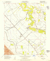
1952 Map of Westley
USGS Topo · Published 1954About this map
The San Joaquin River meanders through this mid-century landscape where the Tuolumne River joins it from the east. The terrain is a complex network of natural sloughs and man-made irrigation infrastructure, characterized by the Delta-Mendota Canal and numerous lateral ditches that support the region's agricultural vitality. Near the settlement of Westley, the Southern Pacific Railroad runs parallel to West Side Road, anchoring the local transportation corridor.
Find a feature on this map
58 named features on this map. Tap any name to fly to it.
Don’t see what you’re looking for? This feature index may not catch every label — zoom into the map to look around manually.
Map Details
Editions of this 1952 Westley Map
This is the sole edition of this map. No revisions or reprints were ever made.
Other maps of this area

1913 · Romain
USGS Topo · 1:31,680

1915 · Vernalis
USGS Topo · 1:31,680

1915 · Ripon
USGS Topo · 1:31,680

1915 · Westport
USGS Topo · 1:31,680

1915 · Westley
USGS Topo · 1:31,680

1915 · Salida
USGS Topo · 1:31,680

1916 · Crows Landing
USGS Topo · 1:31,680

1916 · Patterson
USGS Topo · 1:31,680

1916 · Romain
USGS Topo · 1:31,680

1919 · Orestimba
USGS Topo · 1:62,500