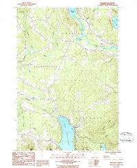
1986 Map of Westmore
USGS Topo · Published 1986About this map
Lake Willoughby dominates this 1980s landscape in Orleans County, where the glacial waters are flanked by the steep elevations of Goodwin Mtn and Valley Mtn. The settlement of Westmore sits at the northern end of the lake, serving as a gateway to the Willoughby State Forest. The hydrology of the region is complex, featuring the north-flowing Clyde River and the winding Willoughby River, which together drain a network of smaller bodies like Pensioner Pond and Echo Lake. Evidence of local industry and infrastructure is visible in the scattered Gravel Pits and the presence of a Boat Ramp and Campgrounds, reflecting the area's dual character as a site of resource extraction and seasonal recreation. Genealogists may find value in the small Cem located near the riverbanks north of the main lake, marking the enduring presence of local families in the Brownington and Charleston townships.
Find a feature on this map
32 named features on this map. Tap any name to fly to it.
Don’t see what you’re looking for? This feature index may not catch every label — zoom into the map to look around manually.
Map Details
Editions of this 1986 Westmore Map
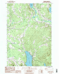
2 editions found
Other maps of this area

1919 · Lake Memphremagog
USGS Topo · 1:62,500

1920 · Derby
USGS Topo · 1:62,500

1923 · Lake Memphremagog
USGS Topo · 1:48,000

1924 · Island Pond
USGS Topo · 1:48,000

1925 · Memphremagog
USGS Topo · 1:62,500

1926 · Island Pond
USGS Topo · 1:62,500

1935 · Lyndonville
USGS Topo · 1:48,000

1939 · Lyndonville
USGS Topo · 1:62,500

1950 · Lake Champlain
USGS Topo · 1:250,000

1950 · Lewiston
USGS Topo · 1:250,000