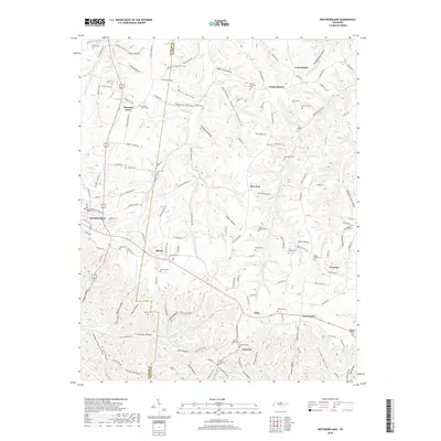
2019 Map of Westmoreland
USGS Topo · Published 2019About this map
Westmoreland sits at a critical intersection of modern and historic transit routes on this upland plateau, where the Austin Peay Hwy and Old Hwy 52 meet. The landscape is deeply dissected by numerous hollows, such as Stillhouse Hollow, Sugar Camp Hollow, and Saltpeter Cave Hollow, indicating a history of diverse land use from traditional distilling to cave resource extraction. Small rural communities like Siloam, Eulia, and Wixtown are scattered across the terrain, often anchored by historic family cemeteries including Millers Chapel Cem and the Walden-Walrond Cem. The drainage pattern is defined by the headwaters of Trammel Cr and Bledsoe Cr, which have shaped the movement of people across the Sumner and Macon county line for generations.
Find a feature on this map
147 named features on this map. Tap any name to fly to it.
Don’t see what you’re looking for? This feature index may not catch every label — zoom into the map to look around manually.
Map Details
Editions of this 2019 Westmoreland Map
This is the sole edition of this map. No revisions or reprints were ever made.
Other maps of this area

1928 · Adolphus
USGS Topo · 1:48,000

1931 · Lafayette
USGS Topo · 1:62,500

1931 · Adolphus
USGS Topo · 1:62,500

1942 · Gallatin
USGS Topo · 1:100,000

1954 · Petroleum
USGS Topo · 1:24,000

1954 · Holland
USGS Topo · 1:24,000

1954 · Adolphus
USGS Topo · 1:24,000

1955 · Bethpage
USGS Topo · 1:24,000

1956 · Nashville
USGS Topo · 1:250,000

1958 · Westmoreland
USGS Topo · 1:24,000