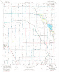
1956 Map of Westmorland
USGS Topo · Published 1980About this map
Westmorland and Calipatria anchor this desert landscape, where an intricate network of irrigation infrastructure transformed the Imperial Valley into a productive agricultural engine. The map reveals an incredible density of canals and drains, such as the Vail Canal, Spruce Canal, and Main Canal, which crisscross the grid-patterned fields. This intensive water management is interrupted by the meandering courses of the New River and Alamo River, which flow toward the Salton Sea north of this area.
Find a feature on this map
55 named features on this map. Tap any name to fly to it.
Don’t see what you’re looking for? This feature index may not catch every label — zoom into the map to look around manually.
Map Details
Editions of this 1956 Westmorland Map
3 editions found
Other maps of this area

1907 · Holtville
USGS Topo · 1:125,000

1915 · El Centro
USGS Topo · 1:125,000

1940 · Brawley
USGS Topo · 1:62,500

1940 · Iris
USGS Topo · 1:62,500

1940 · Alamorio
USGS Topo · 1:62,500

1942 · El Centro
USGS Topo · 1:250,000

1943 · Brawley
USGS Topo · 1:62,500

1944 · Calipatria
USGS Topo · 1:62,500

1945 · Alamorio
USGS Topo · 1:62,500

1945 · Iris
USGS Topo · 1:62,500