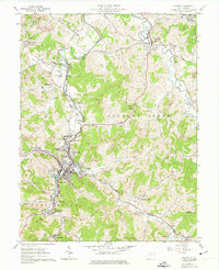
1961 Map of Weston
USGS Topo · Published 1974About this map
The West Fork River winds through the heart of this Lewis County landscape, anchoring the development of Weston and its surrounding neighborhoods like Shady Brook and Kitsonville. During the early 1960s, the area's infrastructure supported both institutional and industrial needs, evidenced by the sprawling Weston State Hospital grounds and the Baltimore and Ohio railroad corridor. Aviation history is noted at Louis Bennett Field, while the energy sector is represented by the Valley Chapel Pumping Station and numerous gas wells. Local life centered around schools and spiritual centers such as Norris Sch and the McCann Run Ch. The map also details extensive cemetery records, including the Masonic Cem and Forest Lawn Mem Gardens, which offer significant value for genealogical research in this West Virginia river valley.
Find a feature on this map
80 named features on this map. Tap any name to fly to it.
Don’t see what you’re looking for? This feature index may not catch every label — zoom into the map to look around manually.
Map Details
Editions of this 1961 Weston Map
3 editions found
Other maps of this area

1893 · Buckhannon
USGS Topo · 1:125,000

1893 · Sutton
USGS Topo · 1:125,000

1896 · Buckhannon
USGS Topo · 1:125,000

1897 · Buckhannon
USGS Topo · 1:125,000

1904 · Weston
USGS Topo · 1:62,500

1904 · Vadis
USGS Topo · 1:62,500

1906 · Burnsville
USGS Topo · 1:62,500

1912 · Crawford
USGS Topo · 1:48,000

1914 · Crawford
USGS Topo · 1:62,500

1925 · Burnsville
USGS Topo · 1:62,500