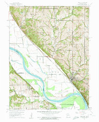
1961 Map of Weston
USGS Topo · Published 1962About this map
The Missouri River forms a wide, sweeping boundary between Kansas and Missouri on this topographic study, carving through a landscape of river-bottom islands and high bluffs. The river’s path is marked by distinctive features like Iatan Bend and Weston Bend, which frame the low-lying Harpst Island and Kickapoo Island. These fertile bottomlands are contrasted by the hilly terrain of the Marshall and Weston townships, where small rural communities like Iatan and Sadler sit along the tracks of the Chicago Burlington and Quincy railroad.
Find a feature on this map
36 named features on this map. Tap any name to fly to it.
Don’t see what you’re looking for? This feature index may not catch every label — zoom into the map to look around manually.
Map Details
Editions of this 1961 Weston Map
3 editions found
Other maps of this area

1885 · Atchison
USGS Topo · 1:125,000

1886 · Oskaloosa
USGS Topo · 1:125,000

1888 · Oskaloosa
USGS Topo · 1:125,000

1888 · Atchison
USGS Topo · 1:125,000

1890 · Kansas City
USGS Topo · 1:125,000

1893 · Atchison
USGS Topo · 1:125,000

1894 · Kansas City
USGS Topo · 1:125,000

1894 · Oskaloosa
USGS Topo · 1:125,000

1910 · Leavenworth
USGS Topo · 1:62,500

1926 · Atchison
USGS Topo · 1:62,500