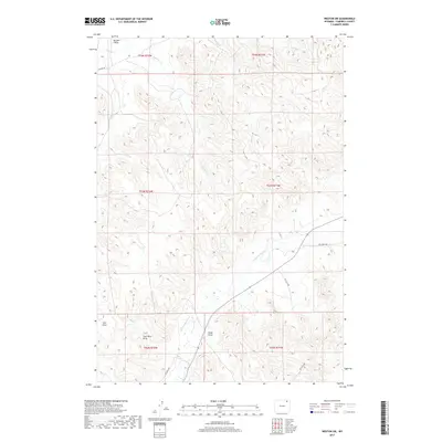
2017 Map of Weston SW
USGS Topo · Published 2017About this map
The Little Powder River winds through this corner of the Powder River Basin, defining a landscape shaped by drainage patterns and resource extraction. The presence of Coal Mine Draw and Oil Field Rd suggests the industrial underpinnings of this Campbell County terrain, where energy development and ranching often overlap. Numerous intermittent watercourses, including Bull Cr, Wildcat Cr, and Number 1 Cr, carve the earth into a series of draws and ridges, such as Garden Draw and Cedar Draw. This 2017 survey documents the modern infrastructure of the region, anchored by the passage of Collins Rd in the north and the utility-driven pathways that service the local oil fields and mines. The density of named draws reflects the importance of topography for navigation and land management in this high-plains environment.
Find a feature on this map
21 named features on this map. Tap any name to fly to it.
Don’t see what you’re looking for? This feature index may not catch every label — zoom into the map to look around manually.
Map Details
Editions of this 2017 Weston SW Map
This is the sole edition of this map. No revisions or reprints were ever made.
Other maps of this area

1954 · Gillette
USGS Topo · 1:250,000

1955 · Gillette
USGS Topo · 1:250,000

1958 · Gillette
USGS Topo · 1:250,000

1962 · Gillette
USGS Topo · 1:250,000
1971 · Pitch Draw
USGS Topo · 1:24,000

1971 · Green Hill
USGS Topo · 1:24,000
1971 · Calf Creek
USGS Topo · 1:24,000
1971 · Rawhide School
USGS Topo · 1:24,000
1971 · Moyer Springs
USGS Topo · 1:24,000
1972 · Oliver Draw
USGS Topo · 1:24,000