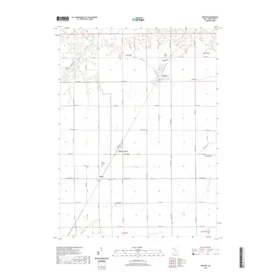
2019 Map of Weston
USGS Topo · Published 2019About this map
Weston serves as a primary hub within Wood County, situated in a landscape defined by an extensive grid of township roads and agricultural drainage systems. The map illustrates a meticulously planned rural infrastructure, where waterways like Cutoff Ditch and the N Br Portage River reflect the region's managed hydrology. For those researching local heritage, the area includes several distinct burial grounds, notably the Old Weston Cem and New Weston Cem, alongside the Milton Township Cem near Milton Center. Further south, the village of Custar is shown at the intersection of Custar Rd and Defiance Pike, with Saint Louis Cem nearby. The dense network of secondary roads, including Otsego Pike and Sand Ridge Rd, highlights the established connectivity between these small Ohio settlements and their surrounding farmstead sections.
Find a feature on this map
49 named features on this map. Tap any name to fly to it.
Don’t see what you’re looking for? This feature index may not catch every label — zoom into the map to look around manually.
Map Details
Editions of this 2019 Weston Map
This is the sole edition of this map. No revisions or reprints were ever made.
Other maps of this area

1901 · Bowling Green
USGS Topo · 1:62,500

1903 · Bowling Green
USGS Topo · 1:62,500

1903 · Findlay
USGS Topo · 1:62,500

1909 · Mc Clure
USGS Topo · 1:62,500

1935 · Grand Rapids
USGS Topo · 1:24,000
1938 · Tontogany
USGS Topo · 1:31,680

1940 · Grand Rapids
USGS Topo · 1:31,680
1952 · Tontogany
USGS Topo · 1:24,000
1952 · Grand Rapids
USGS Topo · 1:24,000

1956 · Toledo
USGS Topo · 1:250,000