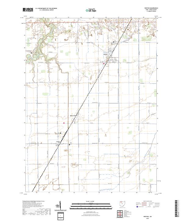
2023 Map of Weston
USGS Topo · Published 2023About this map
Weston and its surrounding Wood County agricultural landscape are defined by a grid of township roads and a network of drainage systems essential to this region of Northwest Ohio. The topography is exceptionally level, relying on features like the Cutoff Ditch and Sugar Creek to manage water flow across the fertile plains. The settlement of Milton Center and the village of Custar serve as local hubs, connected by a strictly geometric road network including the Defiance Pike and Sand Ridge Rd.
Find a feature on this map
52 named features on this map. Tap any name to fly to it.
Don’t see what you’re looking for? This feature index may not catch every label — zoom into the map to look around manually.
Map Details
Editions of this 2023 Weston Map
This is the sole edition of this map. No revisions or reprints were ever made.
Other maps of this area

1901 · Bowling Green
USGS Topo · 1:62,500

1903 · Bowling Green
USGS Topo · 1:62,500

1903 · Findlay
USGS Topo · 1:62,500

1909 · Mc Clure
USGS Topo · 1:62,500

1935 · Grand Rapids
USGS Topo · 1:24,000
1938 · Tontogany
USGS Topo · 1:31,680

1940 · Grand Rapids
USGS Topo · 1:31,680
1952 · Tontogany
USGS Topo · 1:24,000
1952 · Grand Rapids
USGS Topo · 1:24,000

1956 · Toledo
USGS Topo · 1:250,000