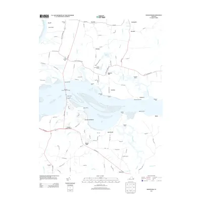
2013 Map of Westover
USGS Topo · Published 2013About this map
The James River serves as the central artery for this region of Virginia, dividing the landscape between the northern settlements of Charles City County and the southern reaches near Garysville. The river is crossed by the Benjamin Harrison Memorial Bridge, connecting Harrison Point to Jordan Point. Along the northern banks, historical landholdings and small communities such as Berkeley, Westover, and Rolands Mill indicate a long-standing pattern of river-oriented settlement.
Find a feature on this map
110 named features on this map. Tap any name to fly to it.
Don’t see what you’re looking for? This feature index may not catch every label — zoom into the map to look around manually.
Map Details
Editions of this 2013 Westover Map
This is the sole edition of this map. No revisions or reprints were ever made.
Other maps of this area

1894 · Bermuda Hundred
USGS Topo · 1:62,500

1894 · Petersburg
USGS Topo · 1:62,500

1918 · Charles City
USGS Topo · 1:62,500

1919 · Disputanta
USGS Topo · 1:62,500

1938 · Dutch Gap
USGS Topo · 1:24,000

1943 · Savedge
USGS Topo · 1:31,680

1943 · Dutch Gap
USGS Topo · 1:31,680

1943 · Hopewell
USGS Topo · 1:31,680

1943 · Disputanta
USGS Topo · 1:31,680

1943 · Richmond
USGS Topo · 1:250,000