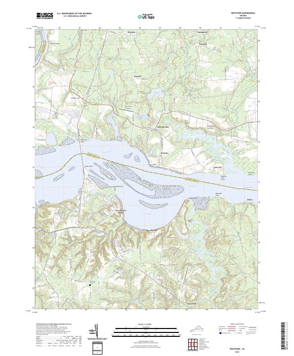
2022 Map of Westover
USGS Topo · Published 2022About this map
The James River dominates this coastal Virginia landscape, carving a wide path between Charles City and Prince George counties. Along its northern banks, historical landholdings and modern developments intersect, evidenced by the Virginia Capital Trl winding past estates like Westover and Berkeley. The map records a transition from traditional river-bound economy to modern recreational and residential uses, with clusters such as Beechwood Manor and Evelynton Heights appearing alongside established landmarks like Rolands Mill. To the south, the terrain becomes increasingly marshy, defined by Powell Creek and the dense wetlands of Wobles Swamp. This area remains punctuated by rural history, from the Merchants Hope Cem to small aviation sites like Henshaw Airport, showing how the tidewater region preserves its colonial-era geographic names while adapting to contemporary infrastructure and transit corridors.
Find a feature on this map
108 named features on this map. Tap any name to fly to it.
Don’t see what you’re looking for? This feature index may not catch every label — zoom into the map to look around manually.
Map Details
Editions of this 2022 Westover Map
This is the sole edition of this map. No revisions or reprints were ever made.
Other maps of this area

1894 · Bermuda Hundred
USGS Topo · 1:62,500

1894 · Petersburg
USGS Topo · 1:62,500

1918 · Charles City
USGS Topo · 1:62,500

1919 · Disputanta
USGS Topo · 1:62,500

1938 · Dutch Gap
USGS Topo · 1:24,000

1943 · Savedge
USGS Topo · 1:31,680

1943 · Dutch Gap
USGS Topo · 1:31,680

1943 · Hopewell
USGS Topo · 1:31,680

1943 · Disputanta
USGS Topo · 1:31,680

1943 · Richmond
USGS Topo · 1:250,000