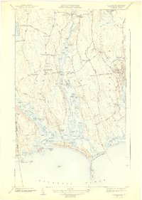
1977 Map of Westport
USGS Topo · Published 1981About this map
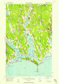
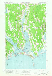
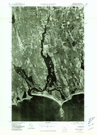
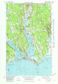
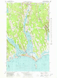
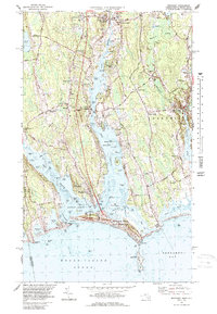
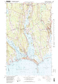
Westport Point sits at the confluence of the East Branch and West Branch in this late 1970s orthophotoquad. The landscape is defined by its coastal geography, where the tidal fingers of the river meet the open waters of Rhode Island Sound and Buzzards Bay. Inland, the settlement pattern follows historical corridors, with small communities like Central Village and South Westport established amidst a mix of wooded areas and cleared fields. This aerial perspective, captured in 1977, reveals the specific parcel boundaries and land use of the era, from the established village at Head of Westport to the rural surroundings of Giffords Corner. The map provides a photographic record of the Massachusetts coast before late-century development, showing the proximity of settlements like Russells Mills to the winding river estuaries.
Find a feature on this map
11 named features on this map. Tap any name to fly to it.
Don’t see what you’re looking for? This feature index may not catch every label — zoom into the map to look around manually.
Map Details
Editions of this 1977 Westport Map
5 editions found
Historical Maps of Dartmouth Through Time
4 maps found