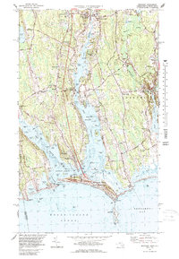
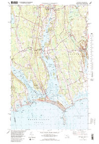
1977 Map of Westport
USGS Topo · Published 1989About this map
The coastal landscapes of Westport and Dartmouth define this mid-1970s coastal survey, revealing a network of historic villages and family-named corners along the Massachusetts-Rhode Island border. The bifurcated Westport River, with its East Branch and West Branch, dominates the central terrain, converging at Westport Point before meeting Rhode Island Sound. Inland, the settlement pattern is marked by numerous traditional crossroads such as Giffords Corner, Sissons Corner, and Slades Corner, reflecting a colonial-era development that persisted through the 20th century.
Find a feature on this map
118 named features on this map. Tap any name to fly to it.
Don’t see what you’re looking for? This feature index may not catch every label — zoom into the map to look around manually.
Map Details
Editions of this 1977 Westport Map
5 editions found
Other maps of this area

1885 · New Bedford
USGS Topo · 1:62,500

1885 · Sakonnet
USGS Topo · 1:62,500

1888 · New Bedford
USGS Topo · 1:62,500

1888 · Fall River
USGS Topo · 1:62,500

1888 · Sakonnet
USGS Topo · 1:62,500

1893 · Sakonnet
USGS Topo · 1:62,500

1893 · Fall River
USGS Topo · 1:62,500

1893 · New Bedford
USGS Topo · 1:62,500

1918 · New Bedford
USGS Topo · 1:62,500

1919 · Fall River
USGS Topo · 1:62,500