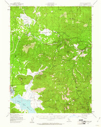
1955 Map of Westwood
USGS Topo · Published 1961About this map
Western Pacific and Southern Pacific rail lines dominate this mid-century landscape in the high country of the Lassen National Forest. The town of Westwood is anchored near the southwestern corner, adjacent to the extensive waters of Mountain Meadows Reservoir and the Westwood Cemetery. The map captures a transition in transportation, showing an old railroad grade alongside active tracks and a jeep trail winding through the timber.
Find a feature on this map
57 named features on this map. Tap any name to fly to it.
Don’t see what you’re looking for? This feature index may not catch every label — zoom into the map to look around manually.
Map Details
Editions of this 1955 Westwood Map
3 editions found

Other maps of this area

1886 · Honey Lake
USGS Topo · 1:250,000

1886 · Lassen Peak
USGS Topo · 1:250,000

1891 · Honey Lake
USGS Topo · 1:250,000

1892 · Lassen Peak
USGS Topo · 1:250,000

1893 · Honey Lake
USGS Topo · 1:250,000

1894 · Lassen Peak
USGS Topo · 1:250,000

1939 · Halls Flat
USGS Topo · 1:125,000

1950 · Kettle Rock
USGS Topo · 1:62,500

1950 · Greenville
USGS Topo · 1:62,500

1954 · Susanville
USGS Topo · 1:62,500