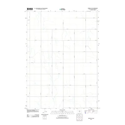
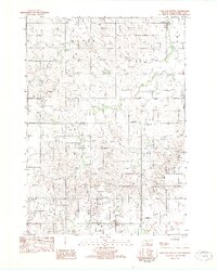
2012 Map of Wewela NE
USGS Topo · Published 2012About this map
Ponca Cr meanders through the northern reaches of this rural landscape, carving a drainage pattern through the undulating terrain of southern Tripp County. This area of the Great Plains is defined by a rigorous section-line road network, where gravel routes such as S Co Rd and 318th Ave provide the primary infrastructure for the sparsely distributed ranching and agricultural operations. The lack of concentrated settlements or industrial markers highlights the open, agrarian character of the land in the early twenty-first century. Numerous unnamed drainages feed into the larger creek system, illustrating the natural water management of the region. The grid of roads, including 287th St and 321st Ave, demarcates the landscape into organized plots typical of the Homestead Act's enduring legacy on the Midwestern geography.
Find a feature on this map
17 named features on this map. Tap any name to fly to it.
Don’t see what you’re looking for? This feature index may not catch every label — zoom into the map to look around manually.
Map Details
Editions of this 2012 Wewela NE Map
This is the sole edition of this map. No revisions or reprints were ever made.
Other maps of this area

1955 · Mitchell
USGS Topo · 1:250,000

1959 · Mitchell
USGS Topo · 1:250,000

1964 · Dallas SW
USGS Topo · 1:24,000

1964 · Dallas NW
USGS Topo · 1:24,000

1971 · Colome
USGS Topo · 1:24,000
1982 · Wewela
USGS Topo · 1:24,000
1982 · Millboro
USGS Topo · 1:24,000

1982 · Winner South
USGS Topo · 1:25,000
1982 · Wewela NE
USGS Topo · 1:24,000
1982 · Dog Ear Buttes
USGS Topo · 1:25,000