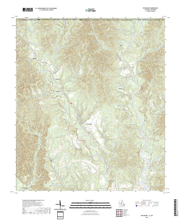
2024 Map of Weyanoke
USGS Topo · Published 2024About this map
Little Bayou Sara and Bayou Sara dominate the drainage patterns of this corner of West Feliciana Parish, where the land transitions through a series of small named settlements and family holdings. The historic Tunica Trce cuts diagonally across the landscape, serving as a primary corridor connecting the communities of Retreat, Turnbull, Weyanoke, and Rosebank. This rural topography is defined by its deep creek systems, including Sandy Creek, Baker Creek, and Bell Creek, which feed into the larger bayou network. Genealogists will find value in the clear placement of Evans Cem near the northern boundary and Greenwood Cem further south. The settlement pattern of small hubs like Plettenberg and Hollywood suggests a landscape rooted in long-standing agricultural and residential partitions, while the presence of Flower Hill and several branch roads illustrates the local connectivity of this riverside region.
Find a feature on this map
43 named features on this map. Tap any name to fly to it.
Don’t see what you’re looking for? This feature index may not catch every label — zoom into the map to look around manually.
Map Details
Editions of this 2024 Weyanoke Map
This is the sole edition of this map. No revisions or reprints were ever made.
Other maps of this area

1906 · Bayou Sara
USGS Topo · 1:125,000

1936 · Woodville
USGS Topo · 1:62,500

1939 · St. Francisville
USGS Topo · 1:62,500

1939 · Artonish
USGS Topo · 1:62,500

1941 · Batchelor
USGS Topo · 1:62,500

1953 · Natchez
USGS Topo · 1:250,000

1954 · Elm Park
USGS Topo · 1:24,000

1954 · Artonish
USGS Topo · 1:62,500

1954 · Baton Rouge
USGS Topo · 1:250,000

1955 · Artonish
USGS Topo · 1:62,500