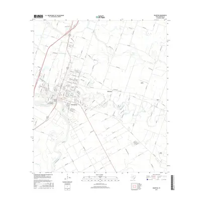
2016 Map of Wharton
USGS Topo · Published 2016About this map
Wharton serves as the focal point of this coastal plain landscape, where the Colorado River makes a dramatic bend toward the south. The city's development is closely tied to its geography, with the Texas and New Orleans Railroad Bridge crossing the river near the historic center. Education and community infrastructure are prominent, anchored by the Wharton County Jr Coll campus and the nearby Little Zion Cem.
Find a feature on this map
172 named features on this map. Tap any name to fly to it.
Don’t see what you’re looking for? This feature index may not catch every label — zoom into the map to look around manually.
Map Details
Editions of this 2016 Wharton Map
This is the sole edition of this map. No revisions or reprints were ever made.
Other maps of this area

1950 · Houston
USGS Topo · 1:250,000

1952 · Pledger
USGS Topo · 1:24,000

1952 · Lane City
USGS Topo · 1:24,000

1952 · Pierce
USGS Topo · 1:24,000

1952 · Egypt
USGS Topo · 1:24,000

1953 · Kendleton
USGS Topo · 1:24,000

1953 · Wharton
USGS Topo · 1:24,000

1953 · Hungerford
USGS Topo · 1:24,000

1953 · Glen Flora
USGS Topo · 1:24,000

1953 · Boling
USGS Topo · 1:24,000