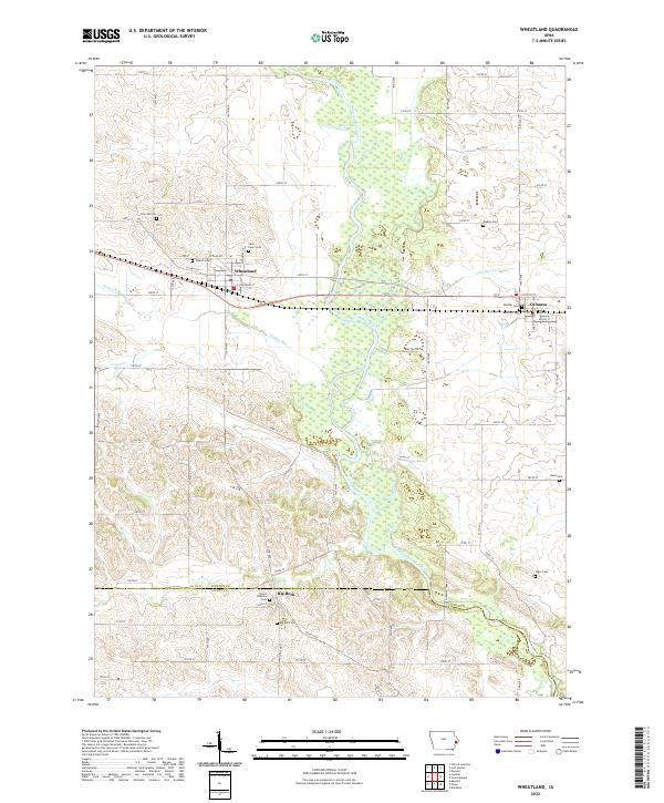
2022 Map of Wheatland
USGS Topo · Published 2022About this map
The Wapsipinicon River meanders through a broad floodplain in this rural Iowa landscape, defining the character of the region. The river's winding path is joined by several tributaries, including Yankee Run and Calamus Creek, creating a network of waterways that historically shaped the placement of local settlements. The town of Wheatland serves as a primary hub, while Calamus sits further east and the village of Big Rock occupies the southern edge near the Clinton and Scott County line.
Find a feature on this map
57 named features on this map. Tap any name to fly to it.
Don’t see what you’re looking for? This feature index may not catch every label — zoom into the map to look around manually.
Map Details
Editions of this 2022 Wheatland Map
This is the sole edition of this map. No revisions or reprints were ever made.
Other maps of this area

1890 · Durant
USGS Topo · 1:62,500

1891 · DeWitt
USGS Topo · 1:62,500

1891 · Davenport
USGS Topo · 1:62,500

1892 · Wheatland
USGS Topo · 1:62,500

1894 · Wheatland
USGS Topo · 1:62,500

1894 · Durant
USGS Topo · 1:62,500

1894 · Davenport
USGS Topo · 1:62,500

1901 · Rock Island
USGS Topo · 1:125,000

1910 · Rock Island
USGS Topo · 1:125,000
1953 · Donahue
USGS Topo · 1:24,000