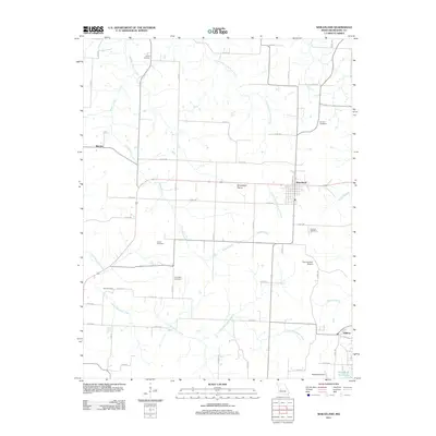
2011 Map of Wheatland
USGS Topo · Published 2011About this map
Wheatland serves as the central hub of this Missouri-Hickory County landscape, where the flat expanses of Wheatland Prairie meet a dense network of creek drainages. The area is defined by the winding paths of Hogles Creek and the Little Pomme de Terre River, which carve through the terrain before reaching the southern waters of Pomme de Terre Lake. This 2011 survey reveals a deeply rooted rural community, marked by numerous family and community burial grounds such as Gentry Cemetery, Gerber Cemetery, and Poe Cemetery scattered along the section lines.
Find a feature on this map
53 named features on this map. Tap any name to fly to it.
Don’t see what you’re looking for? This feature index may not catch every label — zoom into the map to look around manually.
Map Details
Editions of this 2011 Wheatland Map
This is the sole edition of this map. No revisions or reprints were ever made.
Other maps of this area

1884 · Bolivar
USGS Topo · 1:125,000

1886 · Stockton
USGS Topo · 1:125,000

1887 · Clinton
USGS Topo · 1:125,000

1887 · Warsaw
USGS Topo · 1:125,000

1892 · Bolivar
USGS Topo · 1:125,000

1894 · Warsaw
USGS Topo · 1:125,000

1894 · Clinton
USGS Topo · 1:125,000

1940 · Weaubleau
USGS Topo · 1:24,000

1940 · Iconium
USGS Topo · 1:24,000

1942 · Elkton
USGS Topo · 1:24,000