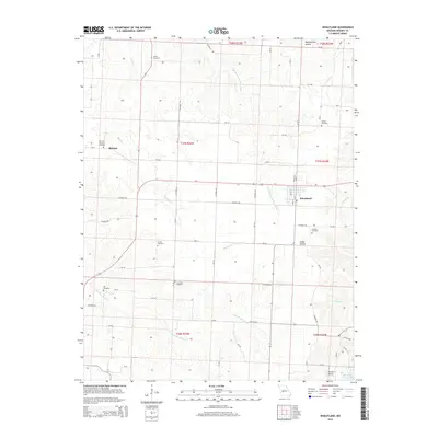
2015 Map of Wheatland
USGS Topo · Published 2015About this map
The settlement of Wheatland sits as a central hub in this landscape, where the Little Pomme de Terre River and Hogles Cr drain through the local hollows. The terrain is defined by a series of named valleys like Montgomery Hollow and Cedar Hollow, which have long dictated the placement of roads and homesteads. Further west, the small community of Butcher is marked by the Fairview Butcher Cemetery, one of many family-named burial grounds scattered across the township lines, including Gentry Cemetery and Sumner Cemetery. The southern reaches of the area transition toward the waters of Pomme de Terre Lake, while the local aviation history is represented by Skyriders Airport. This network of country roads, from Co Road 180 to Mo-Aa, connects these rural enclaves, providing a clear view of the area's established property and settlement patterns.
Find a feature on this map
104 named features on this map. Tap any name to fly to it.
Don’t see what you’re looking for? This feature index may not catch every label — zoom into the map to look around manually.
Map Details
Editions of this 2015 Wheatland Map
This is the sole edition of this map. No revisions or reprints were ever made.
Other maps of this area

1884 · Bolivar
USGS Topo · 1:125,000

1886 · Stockton
USGS Topo · 1:125,000

1887 · Clinton
USGS Topo · 1:125,000

1887 · Warsaw
USGS Topo · 1:125,000

1892 · Bolivar
USGS Topo · 1:125,000

1894 · Warsaw
USGS Topo · 1:125,000

1894 · Clinton
USGS Topo · 1:125,000

1940 · Weaubleau
USGS Topo · 1:24,000

1940 · Iconium
USGS Topo · 1:24,000

1942 · Elkton
USGS Topo · 1:24,000