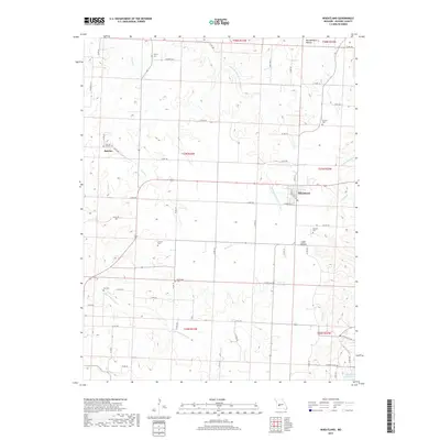
2017 Map of Wheatland
USGS Topo · Published 2017About this map
Wheatland serves as the primary hub in this portion of Hickory County, centered at the crossroads of several local arteries including Main St and W Sunshine St. The surrounding landscape is defined by the winding course of the Little Pomme de Terre River and the northern reaches of Pomme de Terre Lake in the southeast. Numerous small family and community burial grounds, such as Gentry Cem, Sumner Cem, and Poe Cem, are scattered across the township grid, offering valuable markers for genealogical research. The small settlement of Butcher lies to the west, near Fairview Butcher Cem. The topography is a mix of agricultural uplands and carved drainages like Montgomery Hollow and Cedar Hollow, reflecting a rural Missouri landscape where life is closely tied to the creek systems of Hogles Cr and Little Weaubleau Cr.
Find a feature on this map
65 named features on this map. Tap any name to fly to it.
Don’t see what you’re looking for? This feature index may not catch every label — zoom into the map to look around manually.
Map Details
Editions of this 2017 Wheatland Map
This is the sole edition of this map. No revisions or reprints were ever made.
Other maps of this area

1884 · Bolivar
USGS Topo · 1:125,000

1886 · Stockton
USGS Topo · 1:125,000

1887 · Clinton
USGS Topo · 1:125,000

1887 · Warsaw
USGS Topo · 1:125,000

1892 · Bolivar
USGS Topo · 1:125,000

1894 · Warsaw
USGS Topo · 1:125,000

1894 · Clinton
USGS Topo · 1:125,000

1940 · Weaubleau
USGS Topo · 1:24,000

1940 · Iconium
USGS Topo · 1:24,000

1942 · Elkton
USGS Topo · 1:24,000