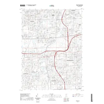
2021 Map of Wheaton
USGS Topo · Published 2021About this map
Wheaton, Glen Ellyn, and Lombard anchor this detailed study of the modern DuPage County suburbs. The landscape is defined by its educational and religious institutions, including Wheaton College, Benedictine University, and the Saint Procopius Abbey Cemetery. Traces of the region's earlier character are visible in the numerous family and community burial grounds, such as the Morton Family Cemetery and The Lisle Cemetery. The drainage of the East Branch Du Page River connects a string of recreational and natural areas, from Danada Swamp to the water bodies of Lake Marmo and Sterling Pond. The regional transport network is heavily represented by the Illinois Prairie Path, a multi-branch trail system that follows former rail corridors, linking the established downtown centers of Lisle and Downers Grove.
Find a feature on this map
51 named features on this map. Tap any name to fly to it.
Don’t see what you’re looking for? This feature index may not catch every label — zoom into the map to look around manually.
Map Details
Editions of this 2021 Wheaton Map
This is the sole edition of this map. No revisions or reprints were ever made.
Other maps of this area

1890 · Des Plaines
USGS Topo · 1:62,500

1891 · Riverside
USGS Topo · 1:62,500

1892 · Joliet
USGS Topo · 1:62,500

1893 · Riverside
USGS Topo · 1:62,500

1894 · Des Plaines
USGS Topo · 1:62,500

1900 · Des Plaines
USGS Topo · 1:62,500

1900 · Riverside
USGS Topo · 1:62,500

1901 · Des Plaines
USGS Topo · 1:62,500

1901 · Riverside
USGS Topo · 1:62,500

1908 · Wheaton
USGS Topo · 1:62,500