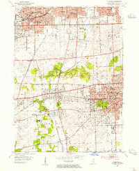
1954 Map of Wheaton
USGS Topo · Published 1955About this map
Educational and religious institutions anchor the mid-century landscape of Milton and Lisle townships. Wheaton serves as a prominent hub, featuring the campus of Wheaton College and the courthouse, while the southern reaches are dominated by the sprawling Morton Arboretum. The region’s development is closely tied to three major rail corridors: the Chicago and North Western, the Chicago Aurora and Elgin, and the Chicago Burlington and Quincy, which spurred the growth of residential clusters in Glen Ellyn, Lombard, and Downers Grove. This era captures the transition from a specialized institutional and agricultural landscape — evidenced by the University of Illinois Experiment Station and the Maryknoll Seminary — into an interconnected suburban network. Significant local landmarks like the Chicago Golf Club and the Lombard Airport reflect the recreational and infrastructure needs of this expanding community during the 1950s.
Find a feature on this map
83 named features on this map. Tap any name to fly to it.
Don’t see what you’re looking for? This feature index may not catch every label — zoom into the map to look around manually.
Map Details
Editions of this 1954 Wheaton Map
This is the sole edition of this map. No revisions or reprints were ever made.
Other maps of this area

1890 · Des Plaines
USGS Topo · 1:62,500

1891 · Riverside
USGS Topo · 1:62,500

1892 · Joliet
USGS Topo · 1:62,500

1893 · Riverside
USGS Topo · 1:62,500

1894 · Des Plaines
USGS Topo · 1:62,500

1900 · Des Plaines
USGS Topo · 1:62,500

1900 · Riverside
USGS Topo · 1:62,500

1901 · Des Plaines
USGS Topo · 1:62,500

1901 · Riverside
USGS Topo · 1:62,500

1908 · Wheaton
USGS Topo · 1:62,500