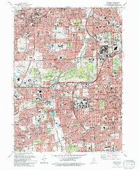
1993 Map of Wheaton
USGS Topo · Published 1994About this map
The Morton Arboretum forms a sprawling green heart for this portion of DuPage County, surrounded by the rapid suburban expansion of the early 1990s. This survey illustrates the dense residential and institutional development of Wheaton, Downers Grove, and Lisle, where major educational centers like Wheaton College and Illinois Benedictine College are central landmarks. The landscape is defined by its transit corridors, from the heavy rail lines of the Chicago and North Western and Burlington Northern to the intersecting paths of the East-West Tollway and North-South Tollway.
Find a feature on this map
77 named features on this map. Tap any name to fly to it.
Don’t see what you’re looking for? This feature index may not catch every label — zoom into the map to look around manually.
Map Details
Editions of this 1993 Wheaton Map
This is the sole edition of this map. No revisions or reprints were ever made.
Other maps of this area

1890 · Des Plaines
USGS Topo · 1:62,500

1891 · Riverside
USGS Topo · 1:62,500

1892 · Joliet
USGS Topo · 1:62,500

1893 · Riverside
USGS Topo · 1:62,500

1894 · Des Plaines
USGS Topo · 1:62,500

1900 · Des Plaines
USGS Topo · 1:62,500

1900 · Riverside
USGS Topo · 1:62,500

1901 · Des Plaines
USGS Topo · 1:62,500

1901 · Riverside
USGS Topo · 1:62,500

1908 · Wheaton
USGS Topo · 1:62,500