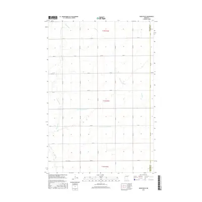
2016 Map of Wheaton SE
USGS Topo · Published 2016About this map
Twelvemile Creek and Fivemile Creek meander across this section of the Red River Valley, illustrating the intricate hydraulic management of a prairie agricultural landscape. This 2016 survey documents a region defined by a rigid section-line road grid, where heavy infrastructure such as County Ditch Number One and County Ditch Number Fiftyone has been integrated to facilitate drainage for large-scale farming. These engineered waterways contrast with the natural winding paths of the local creeks. Evidence of early community settlement is preserved at Zion Cemetery along CO RD 82, a point of interest for genealogists tracking local families. The map also captures the convergence of three administrative boundaries, showing where Traverse, Grant, and Stevens counties meet, a detail significant for understanding historical land records and regional jurisdictions.
Find a feature on this map
40 named features on this map. Tap any name to fly to it.
Don’t see what you’re looking for? This feature index may not catch every label — zoom into the map to look around manually.
Map Details
Editions of this 2016 Wheaton SE Map
This is the sole edition of this map. No revisions or reprints were ever made.
Other maps of this area

1910 · Chokio
USGS Topo · 1:62,500

1911 · Herman
USGS Topo · 1:62,500

1912 · Chokio
USGS Topo · 1:62,500

1950 · Graceville
USGS Topo · 1:62,500

1951 · Wheaton
USGS Topo · 1:62,500

1953 · Milbank
USGS Topo · 1:250,000

1958 · Milbank
USGS Topo · 1:250,000

1973 · Herman NW
USGS Topo · 1:24,000
1973 · Herman
USGS Topo · 1:24,000
1973 · Chokio NW
USGS Topo · 1:24,000