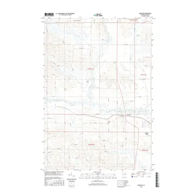
2015 Map of Wheeler
USGS Topo · Published 2015About this map
Wheeler serves as the central hub of this Wisconsin landscape, situated at the confluence of the Hay River and the S Fork Hay River. The map illustrates a highly developed grid of rural roads, including Sawmill Rd and Co Rd N, which connect the town to surrounding agricultural lands. Notable for local family historians, the sheet identifies the Hay River Cem and Our Saviors Cem, both key markers of the community's early settlement. The geography is defined by a dense network of watercourses, with Big Beaver Cr, Little Beaver Cr, and Blairmoor Br draining the northern territory, while the southeast corner touches upon the waters of Tainter Lake. This drainage pattern suggests a landscape shaped by glacial activity, where numerous small tributaries like Little Lambs Cr feed into the primary river valleys.
Find a feature on this map
58 named features on this map. Tap any name to fly to it.
Don’t see what you’re looking for? This feature index may not catch every label — zoom into the map to look around manually.
Map Details
Editions of this 2015 Wheeler Map
This is the sole edition of this map. No revisions or reprints were ever made.
Other maps of this area

1940 · Menomonie
USGS Topo · 1:62,500

1942 · Menomonie
USGS Topo · 1:62,500

1946 · Knapp
USGS Topo · 1:62,500

1948 · Downing
USGS Topo · 1:62,500

1949 · Knapp
USGS Topo · 1:62,500

1949 · Ridgeland
USGS Topo · 1:62,500

1950 · Downing
USGS Topo · 1:62,500

1951 · Ridgeland
USGS Topo · 1:62,500

1953 · Saint Paul
USGS Topo · 1:250,000

1953 · Eau Claire
USGS Topo · 1:250,000