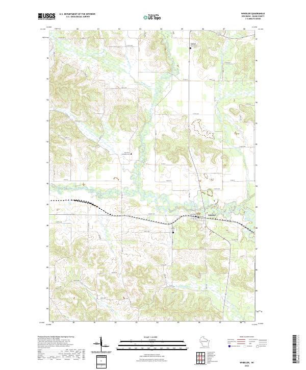
2022 Map of Wheeler
USGS Topo · Published 2022About this map
The village of Wheeler serves as the focal point for this map of Dunn County, situated at the confluence where Big Beaver Cr and other tributaries meet the Hay River. The landscape is characterized by its complex drainage network, with the South Fork Hay River winding through the western sections before joining the main stem near the town center. This area reflects a long-established rural community structured around the river and the historical rail corridor, now marked by W Railroad Ave and Sawmill Rd. Genealogists will find significant value in the documentation of local burial sites, including Hay River Lutheran Church Cem to the north and Our Saviors Cem located just south of the village. The placement of the Hay River Township Cem further west underscores the dispersed nature of the original settlements that grew up along these waterways.
Find a feature on this map
62 named features on this map. Tap any name to fly to it.
Don’t see what you’re looking for? This feature index may not catch every label — zoom into the map to look around manually.
Map Details
Editions of this 2022 Wheeler Map
This is the sole edition of this map. No revisions or reprints were ever made.
Other maps of this area

1940 · Menomonie
USGS Topo · 1:62,500

1942 · Menomonie
USGS Topo · 1:62,500

1946 · Knapp
USGS Topo · 1:62,500

1948 · Downing
USGS Topo · 1:62,500

1949 · Knapp
USGS Topo · 1:62,500

1949 · Ridgeland
USGS Topo · 1:62,500

1950 · Downing
USGS Topo · 1:62,500

1951 · Ridgeland
USGS Topo · 1:62,500

1953 · Saint Paul
USGS Topo · 1:250,000

1953 · Eau Claire
USGS Topo · 1:250,000