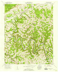
1956 Map of Wheeler
USGS Topo · Published 1958About this map
The Powell River snakes through the heart of Claiborne County in this mid-century portrait, defining a landscape of deep hollows and sharp ridges along the Tennessee-Virginia border. This area is historically significant as a corridor for westward migration, marked by the Old Wilderness Road and the Daniel Boone Trail passing north of Poor Valley Ridge. Settlement patterns follow the water and rail, with Gibson Sta PO and Gibson Station situated along the Louisville and Nashville tracks. The rural economy of the 1950s is evident in the presence of Gibson Mill and Nash Mill, while the social fabric is anchored by numerous country houses of worship like Walnut Hill Ch and Greers Chapel. The map documents numerous river crossings, including Russell Ford and Yellow Shoals Ford, and the winding Massengill Bend, before the river enters the complex loops of the Double S Bend.
Find a feature on this map
113 named features on this map. Tap any name to fly to it.
Don’t see what you’re looking for? This feature index may not catch every label — zoom into the map to look around manually.
Map Details
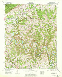
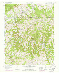
Editions of this 1956 Wheeler Map
3 editions found
Other maps of this area

1883 · Morristown
USGS Topo · 1:125,000

1886 · Cumberland Gap
USGS Topo · 1:125,000

1887 · Jonesville
USGS Topo · 1:125,000

1888 · Cumberland Gap
USGS Topo · 1:125,000

1891 · Cumberland Gap
USGS Topo · 1:125,000

1891 · Jonesville
USGS Topo · 1:125,000

1893 · Morristown
USGS Topo · 1:125,000

1895 · Morristown
USGS Topo · 1:125,000

1897 · Maynardville
USGS Topo · 1:125,000

1900 · Maynardville
USGS Topo · 1:125,000