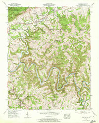
1956 Map of Wheeler
USGS Topo · Published 1972About this map
Cumberland Gap National Historical Park anchors the northwestern corner of this landscape, where historical transit routes converged to cross the mountain barrier. The Old Wilderness Road and Daniel Boone Trail parallel the Louisville and Nashville tracks, tracing a narrow corridor of development through Wheeler and Gibson Sta. To the south, the Powell River carves a dramatic series of loops including Ellison Bend and Massengill Bend. This river-defined terrain is dotted with small-scale industry and community life, from the Nash Mill near Gibson Station to the Riverside Sch and Cosby Bridge. The map reveals a high density of family-named cemeteries such as Colson Cem and Hammock Cem, reflecting generations of settlement along the narrow hollows and ridges that define the Tennessee-Virginia borderlands.
Find a feature on this map
111 named features on this map. Tap any name to fly to it.
Don’t see what you’re looking for? This feature index may not catch every label — zoom into the map to look around manually.
Map Details
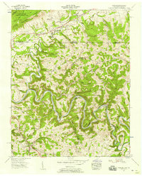
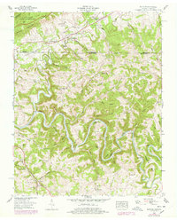
Editions of this 1956 Wheeler Map
3 editions found
Other maps of this area

1883 · Morristown
USGS Topo · 1:125,000

1886 · Cumberland Gap
USGS Topo · 1:125,000

1887 · Jonesville
USGS Topo · 1:125,000

1888 · Cumberland Gap
USGS Topo · 1:125,000

1891 · Cumberland Gap
USGS Topo · 1:125,000

1891 · Jonesville
USGS Topo · 1:125,000

1893 · Morristown
USGS Topo · 1:125,000

1895 · Morristown
USGS Topo · 1:125,000

1897 · Maynardville
USGS Topo · 1:125,000

1900 · Maynardville
USGS Topo · 1:125,000