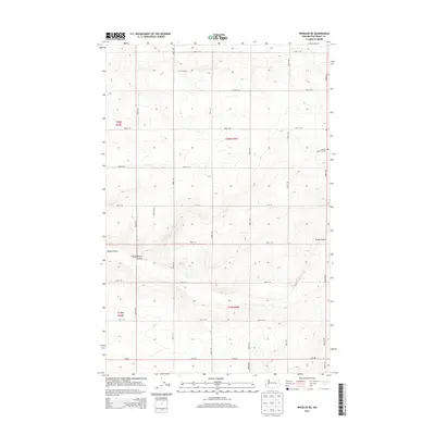
2014 Map of Wheeler NE
USGS Topo · Published 2014About this map
Rocky Coulee and Rocky Branch Coulee define the natural drainage patterns of this high desert landscape in central Washington. The terrain is organized by a strict grid of section lines and gravel paths, including Road 11 NE and Road 4 NE, reflecting the expansive agricultural development typical of the Columbia Basin. The only marked cultural landmark of historical significance is the Schultz Memorial Cem, situated on the eastern edge of the survey area near the intersection of Road 9 NE. This specific survey emphasizes the contrast between the natural basalt coulees and the human-imposed geometric order of roads and township boundaries like t20n r30e and t19n r30e.
Find a feature on this map
19 named features on this map. Tap any name to fly to it.
Don’t see what you’re looking for? This feature index may not catch every label — zoom into the map to look around manually.
Map Details
Editions of this 2014 Wheeler NE Map
This is the sole edition of this map. No revisions or reprints were ever made.
Other maps of this area

1923 · Wheeler
USGS Topo · 1:62,500

1925 · Wheeler
USGS Topo · 1:62,500

1925 · Schrag
USGS Topo · 1:62,500

1953 · Ritzville
USGS Topo · 1:250,000

1956 · Wheeler
USGS Topo · 1:24,000

1956 · Wilson Creek SW
USGS Topo · 1:24,000
1956 · Bassett Junction
USGS Topo · 1:24,000

1956 · Wheeler NE
USGS Topo · 1:24,000

1956 · Wilson Creek SE
USGS Topo · 1:24,000

1956 · Wilson Creek
USGS Topo · 1:62,500