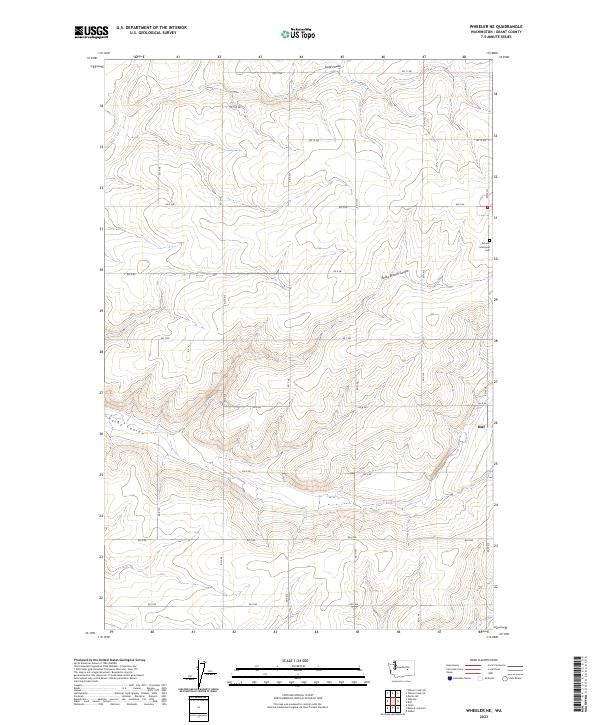
2023 Map of Wheeler NE
USGS Topo · Published 2023About this map
Rocky Branch Coulee and Rocky Coulee carve through this section of Grant County, where the high desert landscape is organized by an exacting grid of section lines and rural roads. The settlement of Ruff sits at the eastern edge of the quadrangle, serving as a focal point for the surrounding agricultural tracts. To the northeast, the Schultz Memorial Cem provides a specific point of interest for genealogists and local historians tracing families in this part of Washington. The terrain is further defined by the winding path of Sand Coulee in the north. This 2023 survey illustrates the enduring rural character of the region, where the network of county roads like RD 11 Ne and RD 3 Ne maintains the connectivity between isolated homesteads and the small community of Ruff.
Find a feature on this map
28 named features on this map. Tap any name to fly to it.
Don’t see what you’re looking for? This feature index may not catch every label — zoom into the map to look around manually.
Map Details
Editions of this 2023 Wheeler NE Map
This is the sole edition of this map. No revisions or reprints were ever made.
Other maps of this area

1923 · Wheeler
USGS Topo · 1:62,500

1925 · Wheeler
USGS Topo · 1:62,500

1925 · Schrag
USGS Topo · 1:62,500

1953 · Ritzville
USGS Topo · 1:250,000

1956 · Wheeler
USGS Topo · 1:24,000

1956 · Wilson Creek SW
USGS Topo · 1:24,000
1956 · Bassett Junction
USGS Topo · 1:24,000

1956 · Wheeler NE
USGS Topo · 1:24,000

1956 · Wilson Creek SE
USGS Topo · 1:24,000

1956 · Wilson Creek
USGS Topo · 1:62,500