
1948 Map of Wheeler Peak
USGS Topo · Published 1961About this map
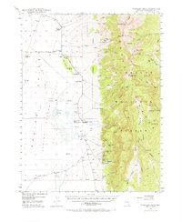
Humboldt National Forest dominates the eastern half of this 1948 survey, where the high peaks of the Snake Range tower over the transition to the Snake Valley. The map documents a rugged landscape defined by its mining and ranching economy, featuring an array of operations like the Tungsten Queen Mine, Everett Mines, and the St Lawrence Mine. Settlement is sparse but concentrated along the mountain base, where numerous family-owned properties such as Robinson Ranch, Floyd Smith Ranch, and Kirkeby Ranch relied on spring-fed water systems. Local civic infrastructure is captured through the Shoshone PO and Consolidated Sch No 2, while specialized industry is represented by a Cement Pipe Factory near the Artesian Wells in the north.
Find a feature on this map
72 named features on this map. Tap any name to fly to it.
Don’t see what you’re looking for? This feature index may not catch every label — zoom into the map to look around manually.
Map Details
Editions of this 1948 Wheeler Peak Map
2 editions found
Other maps of this area

1949 · Garrison
USGS Topo · 1:62,500

1950 · Wheeler Peak
USGS Topo · 1:62,500

1951 · Garrison
USGS Topo · 1:62,500

1952 · Ely
USGS Topo · 1:125,000

1956 · Lund
USGS Topo · 1:250,000

1956 · Ely
USGS Topo · 1:250,000

1959 · Ely
USGS Topo · 1:250,000

1959 · Sacramento Pass
USGS Topo · 1:62,500

1959 · Connors Pass
USGS Topo · 1:62,500

1960 · Lund
USGS Topo · 1:250,000