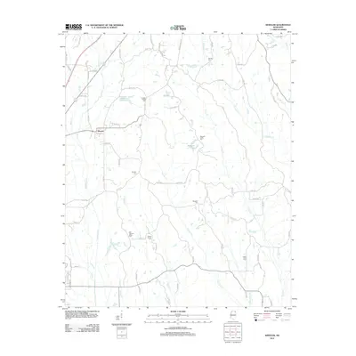
2012 Map of Wheeler
USGS Topo · Published 2012About this map
Wheeler stands as the primary settlement in this corner of Northeast Mississippi, situated at a junction of roads where the landscape begins to drain into numerous creeks and branches. The area is defined by a dense network of waterways, including Donivan Cr, Twentymile Cr, and Hurricane Cr, which carve through the terrain and create a pattern of low-lying basins like Elder Lake and Bennett Lake.
Find a feature on this map
87 named features on this map. Tap any name to fly to it.
Don’t see what you’re looking for? This feature index may not catch every label — zoom into the map to look around manually.
Map Details
Editions of this 2012 Wheeler Map
This is the sole edition of this map. No revisions or reprints were ever made.
Other maps of this area

1921 · Booneville
USGS Topo · 1:48,000

1921 · Tupelo
USGS Topo · 1:48,000

1922 · Booneville
USGS Topo · 1:62,500

1923 · Tupelo
USGS Topo · 1:62,500

1950 · Altitude
USGS Topo · 1:24,000

1956 · Tupelo
USGS Topo · 1:250,000

1958 · Tupelo
USGS Topo · 1:250,000
1965 · Marietta
USGS Topo · 1:24,000

1965 · Kirkville
USGS Topo · 1:24,000

1972 · Jumpertown
USGS Topo · 1:24,000