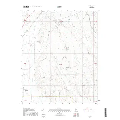
2020 Map of Wheeler
USGS Topo · Published 2020About this map
The boundary between Prentiss and Lee counties cuts through this portion of northeast Mississippi, where the landscape is defined by the headwaters of Twentymile Creek and Dugger Cr. The small community of Wheeler sits at the intersection of Wheeler Rd and local routes, surrounded by a high density of rural cemeteries and small family churches that indicate long-standing settlement patterns. Notable sites for genealogists include Old County Home Cem and the House of Prayer Church. The terrain is marked by numerous water bodies like Elder Lake and Bennett Lake, and small drainage features such as Osborne Cr and Boyer Cr. This survey illustrates the modern road network, including numerous county roads like Co Rd 5001 and Co Rd 5111, connecting these disparate rural landmarks and agricultural tracts.
Find a feature on this map
91 named features on this map. Tap any name to fly to it.
Don’t see what you’re looking for? This feature index may not catch every label — zoom into the map to look around manually.
Map Details
Editions of this 2020 Wheeler Map
This is the sole edition of this map. No revisions or reprints were ever made.
Other maps of this area

1921 · Booneville
USGS Topo · 1:48,000

1921 · Tupelo
USGS Topo · 1:48,000

1922 · Booneville
USGS Topo · 1:62,500

1923 · Tupelo
USGS Topo · 1:62,500

1950 · Altitude
USGS Topo · 1:24,000

1956 · Tupelo
USGS Topo · 1:250,000

1958 · Tupelo
USGS Topo · 1:250,000
1965 · Marietta
USGS Topo · 1:24,000

1965 · Kirkville
USGS Topo · 1:24,000

1972 · Jumpertown
USGS Topo · 1:24,000