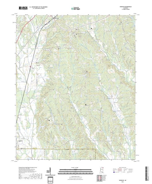
2024 Map of Wheeler
USGS Topo · Published 2024About this map
Booneville, Wheeler, and Baldwyn define the settlement corridor of this Prentiss County landscape, connected by a network of rural routes like Wheeler Rd and Co Rd 5011. The terrain is shaped by the drainage patterns of Donivan Creek, Twentymile Creek, and Hurricane Creek, which carve through the ridges and bottomlands. This area is notably dense with small family and community burial grounds, providing a significant resource for genealogical research. Sites such as the Old County Home Cem and Hodges Chapel Cem are scattered across the township lines, often situated near local landmarks like East Pleasant Ridge or water bodies such as Elder Lake. The map illustrates the contemporary rural character of Mississippi's hill country, where agriculture and small-town life are organized around these longstanding geographic and community markers.
Find a feature on this map
102 named features on this map. Tap any name to fly to it.
Don’t see what you’re looking for? This feature index may not catch every label — zoom into the map to look around manually.
Map Details
Editions of this 2024 Wheeler Map
This is the sole edition of this map. No revisions or reprints were ever made.
Other maps of this area

1921 · Booneville
USGS Topo · 1:48,000

1921 · Tupelo
USGS Topo · 1:48,000

1922 · Booneville
USGS Topo · 1:62,500

1923 · Tupelo
USGS Topo · 1:62,500

1950 · Altitude
USGS Topo · 1:24,000

1956 · Tupelo
USGS Topo · 1:250,000

1958 · Tupelo
USGS Topo · 1:250,000
1965 · Marietta
USGS Topo · 1:24,000

1965 · Kirkville
USGS Topo · 1:24,000

1972 · Jumpertown
USGS Topo · 1:24,000