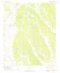
1973 Map of Wheeler
USGS Topo · Published 1975About this map
The community of Wheeler serves as a central hub on this 1970s survey, situated along the Illinois Central Gulf railroad line. The landscape is defined by the headwaters of numerous waterways, including Twentymile Creek, Donivan Creek, and Casey Creek, which carve through the terrain between Prentiss and Lee counties. The map captures a high density of rural institutions that offer significant value for genealogical research, ranging from Hopewell Primitive Ch to smaller family-named landmarks like Elder Lake.
Find a feature on this map
33 named features on this map. Tap any name to fly to it.
Don’t see what you’re looking for? This feature index may not catch every label — zoom into the map to look around manually.
Map Details
Editions of this 1973 Wheeler Map
This is the sole edition of this map. No revisions or reprints were ever made.
Other maps of this area

1921 · Booneville
USGS Topo · 1:48,000

1921 · Tupelo
USGS Topo · 1:48,000

1922 · Booneville
USGS Topo · 1:62,500

1923 · Tupelo
USGS Topo · 1:62,500

1950 · Altitude
USGS Topo · 1:24,000

1956 · Tupelo
USGS Topo · 1:250,000

1958 · Tupelo
USGS Topo · 1:250,000
1965 · Marietta
USGS Topo · 1:24,000

1965 · Kirkville
USGS Topo · 1:24,000

1972 · Jumpertown
USGS Topo · 1:24,000