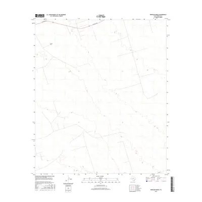
2016 Map of Wheeler Ranch
USGS Topo · Published 2016About this map
Wheeler Ranch sits in the open terrain of Winkler County, representing the ranching heritage that persists in the Permian Basin region of West Texas. The landscape is primarily defined by its subtle elevation changes and the presence of sparse desert vegetation, typical of the high plains. Infrastructure is limited to a few arterial routes and ranching access roads, most notably Jim Sharp Blvd which traverses the northern reaches of the quadrangle. This 2016 survey provides a clear view of the modern land use patterns, where traditional livestock operations exist alongside a grid of local connectors like Co Rd 404 in the southeast. For those studying the geography of West Texas, this map illustrates the relationship between isolated ranching outposts and the vast, open expanses of the Texas panhandle boundary.
Find a feature on this map
3 named features on this map. Tap any name to fly to it.
Don’t see what you’re looking for? This feature index may not catch every label — zoom into the map to look around manually.
Map Details
Editions of this 2016 Wheeler Ranch Map
This is the sole edition of this map. No revisions or reprints were ever made.
Other maps of this area

1954 · Pecos
USGS Topo · 1:250,000

1957 · Pecos
USGS Topo · 1:250,000

1968 · Cowden Place
USGS Topo · 1:24,000

1968 · China Ranch
USGS Topo · 1:24,000

1969 · Pyote NE
USGS Topo · 1:24,000

1970 · Vesrue
USGS Topo · 1:24,000

1970 · Kermit
USGS Topo · 1:24,000

1971 · Notrees
USGS Topo · 1:24,000

1971 · Notrees NW
USGS Topo · 1:24,000
1971 · Amburgey Ranch
USGS Topo · 1:24,000