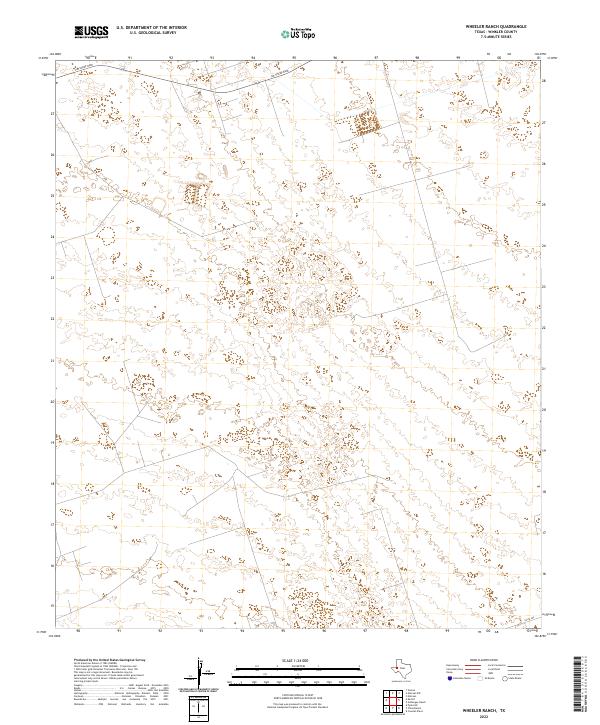
2022 Map of Wheeler Ranch
USGS Topo · Published 2022About this map
Sand dunes and desert terrain dominate this portion of Winkler County, where the topography is defined by the shifting contours of the West Texas landscape. The most prominent corridor through this arid expanse is Jim Sharp Blvd, which traverses the northern reaches of the quadrangle. In the southeast corner, Co Rd 404 provides a brief terrestrial link in an otherwise sparsely developed area. This survey reveals a landscape largely devoid of dense settlement, reflecting the remote nature of the ranching and energy-rich lands that characterize this part of the Permian Basin region in the early twenty-first century.
Find a feature on this map
2 named features on this map. Tap any name to fly to it.
Don’t see what you’re looking for? This feature index may not catch every label — zoom into the map to look around manually.
Map Details
Editions of this 2022 Wheeler Ranch Map
This is the sole edition of this map. No revisions or reprints were ever made.
Other maps of this area

1954 · Pecos
USGS Topo · 1:250,000

1957 · Pecos
USGS Topo · 1:250,000

1968 · Cowden Place
USGS Topo · 1:24,000

1968 · China Ranch
USGS Topo · 1:24,000

1969 · Pyote NE
USGS Topo · 1:24,000

1970 · Vesrue
USGS Topo · 1:24,000

1970 · Kermit
USGS Topo · 1:24,000

1971 · Notrees
USGS Topo · 1:24,000

1971 · Notrees NW
USGS Topo · 1:24,000
1971 · Amburgey Ranch
USGS Topo · 1:24,000