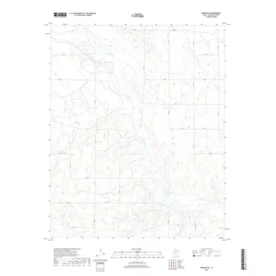
2019 Map of Wheeler SE
USGS Topo · Published 2019About this map
The N Fork Red River carves a broad path through this portion of the Texas Panhandle, defining the hydrography of a landscape largely shaped by seasonal drainage and agricultural access. In the southeastern corner of Wheeler County, the river is fed by numerous tributaries including Bronco Cr, Sand Cr, and Cole Creek. This 2019 survey illustrates the organized grid of county roads that facilitate movement across the plains, where small bodies of water like Wardlow Lake provide rare catchments in the drainage basin. The map documents the persistent rural character of the region, where state routes such as FM 592 and FM 3075 connect remote ranching and farming operations to the wider county infrastructure.
Find a feature on this map
23 named features on this map. Tap any name to fly to it.
Don’t see what you’re looking for? This feature index may not catch every label — zoom into the map to look around manually.
Map Details
Editions of this 2019 Wheeler SE Map
This is the sole edition of this map. No revisions or reprints were ever made.
Other maps of this area

1954 · Amarillo
USGS Topo · 1:250,000

1958 · Amarillo
USGS Topo · 1:250,000

1962 · Twitty
USGS Topo · 1:24,000

1962 · Wheeler
USGS Topo · 1:24,000

1962 · Spring Creek
USGS Topo · 1:24,000

1962 · Wheeler SE
USGS Topo · 1:24,000

1962 · Pakan
USGS Topo · 1:24,000

1963 · Kelton NW
USGS Topo · 1:24,000

1963 · Ramsdell
USGS Topo · 1:24,000

1963 · Shamrock East
USGS Topo · 1:24,000