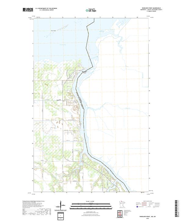
2022 Map of Wheelers Point
USGS Topo · Published 2022About this map
Wheelers Point stands as a primary gateway where the Rainy River meets the expansive waters of Lake of the Woods. This 2022 survey captures a distinct border landscape defined by the international boundary between the United States and Canada. The settlement at Hackett and the residential clusters along Oak Harbor Dr and Birchview Dr NW reflect a local economy tied to the waterfront and the surrounding timberlands. Numerous tributaries, including Winter Road River, Wabanica Creek, and Wilson Creek, drain into the Rainy River, creating a complex network of wetlands and riparian corridors. To the north, Pine Island and the sheltered waters of Fourmile Bay illustrate the transition from riverine environments to the open lake, while a grid of county roads like Co St-Aid Hwy 32 provides access through the low-lying terrain of Lake of the Woods County.
Find a feature on this map
49 named features on this map. Tap any name to fly to it.
Don’t see what you’re looking for? This feature index may not catch every label — zoom into the map to look around manually.
Map Details
Editions of this 2022 Wheelers Point Map
This is the sole edition of this map. No revisions or reprints were ever made.
Other maps of this area

1918 · Williams
USGS Topo · 1:62,500

1919 · Peppermint Creek
USGS Topo · 1:62,500

1919 · Canada
USGS Topo · 1:62,500

1921 · Baudette
USGS Topo · 1:62,500

1943 · Peppermint Creek
USGS Topo · 1:62,500

1954 · Roseau
USGS Topo · 1:250,000

1957 · Roseau
USGS Topo · 1:250,000

1958 · Roseau
USGS Topo · 1:250,000
1967 · Williams SE
USGS Topo · 1:24,000
1967 · Wheelers Point
USGS Topo · 1:24,000