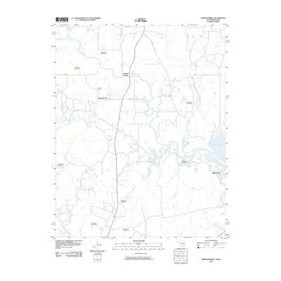
2010 Map of Whippoorwill
USGS Topo · Published 2010About this map
Boulanger Cemetery and the nearby settlement of Boulangerville serve as primary historical touchpoints in this northern Osage County landscape. Situated along the winding course of the Caney River, the area is defined by its complex network of tributaries, including Birch Creek and Turkey Creek. The map documents a rural environment where land use is closely tied to water management, evidenced by several numbered dams and the Hulah Restocking Pond Dam. In the eastern portion of the quadrangle, the reach of Hulah Lake shapes the terrain, while to the west, Artillery Mountain provides a distinct change in elevation. Small, named locales like Boulanger Landing and Whippoorwill reflect the dispersed nature of human settlement in this region near the Oklahoma-Kansas border.
Find a feature on this map
33 named features on this map. Tap any name to fly to it.
Don’t see what you’re looking for? This feature index may not catch every label — zoom into the map to look around manually.
Map Details
Editions of this 2010 Whippoorwill Map
This is the sole edition of this map. No revisions or reprints were ever made.
Other maps of this area

1885 · Sedan
USGS Topo · 1:125,000

1889 · Sedan
USGS Topo · 1:125,000

1909 · Pawhuska
USGS Topo · 1:125,000

1910 · Pawhuska
USGS Topo · 1:125,000

1955 · Wichita
USGS Topo · 1:250,000

1955 · Enid
USGS Topo · 1:250,000

1958 · Enid
USGS Topo · 1:250,000

1958 · Wichita
USGS Topo · 1:250,000

1960 · Nanos
USGS Topo · 1:24,000

1960 · Herd
USGS Topo · 1:24,000