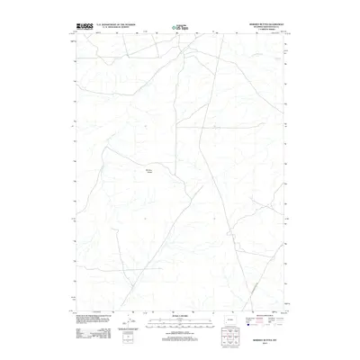
2012 Map of Whiskey Buttes
USGS Topo · Published 2012About this map
Brigham Young 1847, a label marking a historic trail route across the high desert, anchors the southeastern portion of this landscape. This corridor follows the migration paths of the mid-19th century, cutting across the arid terrain of Sweetwater County. The map is defined by its subtle drainage patterns, notably the winding path of the S Fork Shute Cr, which meanders toward the more substantial Shute Cr in the north. The namesake Whiskey Buttes stand as a central landmark amidst a network of modern access roads and intermittent water channels. These landforms and historic markers provide a clear view of how early western travel routes were dictated by the natural topography of the basin.
Find a feature on this map
4 named features on this map. Tap any name to fly to it.
Don’t see what you’re looking for? This feature index may not catch every label — zoom into the map to look around manually.
Map Details
Editions of this 2012 Whiskey Buttes Map
This is the sole edition of this map. No revisions or reprints were ever made.
Other maps of this area

1954 · Ogden
USGS Topo · 1:250,000

1954 · Rock Springs
USGS Topo · 1:250,000

1958 · Ogden
USGS Topo · 1:250,000

1958 · Rock Springs
USGS Topo · 1:250,000

1960 · Ogden
USGS Topo · 1:250,000

1961 · Blue Point
USGS Topo · 1:24,000

1961 · Sevenmile Gulch
USGS Topo · 1:24,000

1962 · Rock Springs
USGS Topo · 1:250,000
1963 · Whiskey Buttes
USGS Topo · 1:24,000
1963 · Mc Cullen Bluff
USGS Topo · 1:24,000