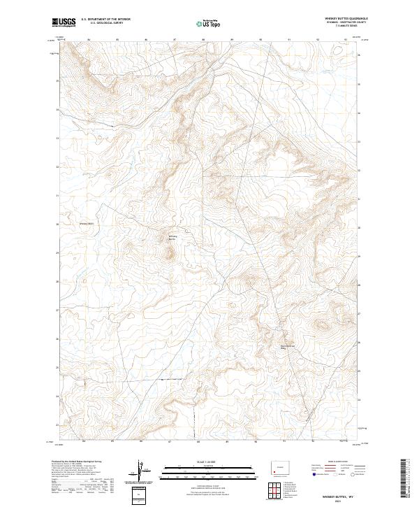
2021 Map of Whiskey Buttes
USGS Topo · Published 2021About this map
The Brigham Young 1847 trail route marks the lower reaches of this Sweetwater County landscape, preserving the historical corridor used during the westward migration. The terrain is characterized by the prominent elevation of the Whiskey Buttes and the adjacent Whiskey Basin, which together define the high desert topography. This modern 2021 survey documents a sparsely settled region where seasonal drainage patterns like the S Fork Shute Cr and Shute Cr feed into the broader West Otterson Wash. The absence of developed towns emphasizes a landscape dedicated to open range and historical transit routes, making it a significant point of interest for those tracing the exact path of mid-19th-century pioneer trails through Wyoming.
Find a feature on this map
10 named features on this map. Tap any name to fly to it.
Don’t see what you’re looking for? This feature index may not catch every label — zoom into the map to look around manually.
Map Details
Editions of this 2021 Whiskey Buttes Map
This is the sole edition of this map. No revisions or reprints were ever made.
Other maps of this area

1954 · Ogden
USGS Topo · 1:250,000

1954 · Rock Springs
USGS Topo · 1:250,000

1958 · Ogden
USGS Topo · 1:250,000

1958 · Rock Springs
USGS Topo · 1:250,000

1960 · Ogden
USGS Topo · 1:250,000

1961 · Blue Point
USGS Topo · 1:24,000

1961 · Sevenmile Gulch
USGS Topo · 1:24,000

1962 · Rock Springs
USGS Topo · 1:250,000
1963 · Whiskey Buttes
USGS Topo · 1:24,000
1963 · Mc Cullen Bluff
USGS Topo · 1:24,000