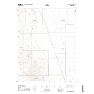
2018 Map of Whistler Mountain
USGS Topo · Published 2018About this map
Whistler Mtn anchors the southern portion of this Eureka County landscape, its high ridges giving way to the expansive flatlands of Diamond Valley. The map reveals a high-desert environment defined by vital water sources, including the distinctively named Stinking Spring in the northwest and Hash Spring and Railroad Spring tucked into the slopes of the central hills. The transition from the steep, contoured terrain of the mountains to the structured grid of the valley floor illustrates a clear divide between the natural uplands and the surveyed tracts below. A network of rural routes such as Saddler Brown Rd and the numbered streets of Diamond Valley suggest a sparse but organized settlement pattern. In the southeast corner, the seasonal flow of Slough Cr marks the low-lying drainage of the basin, reflecting the intricate hydrology of this arid Nevada region.
Find a feature on this map
22 named features on this map. Tap any name to fly to it.
Don’t see what you’re looking for? This feature index may not catch every label — zoom into the map to look around manually.
Map Details
Editions of this 2018 Whistler Mountain Map
This is the sole edition of this map. No revisions or reprints were ever made.
Other maps of this area

1926 · Roberts Mountains
USGS Topo · 1:250,000

1929 · Roberts Mountains
USGS Topo · 1:250,000

1949 · Garden Valley
USGS Topo · 1:62,500

1951 · Garden Valley
USGS Topo · 1:62,500

1953 · Eureka
USGS Topo · 1:62,500

1955 · Millett
USGS Topo · 1:250,000

1956 · Whistler Mtn
USGS Topo · 1:62,500

1956 · Ely
USGS Topo · 1:250,000

1957 · Diamond Springs
USGS Topo · 1:62,500

1959 · Ely
USGS Topo · 1:250,000