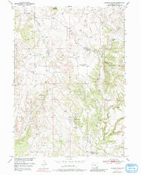
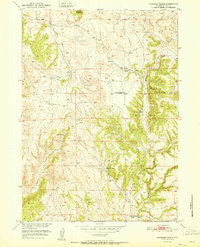
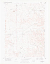
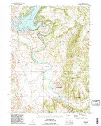
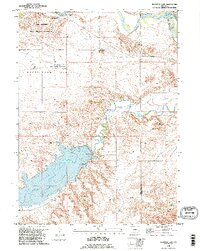
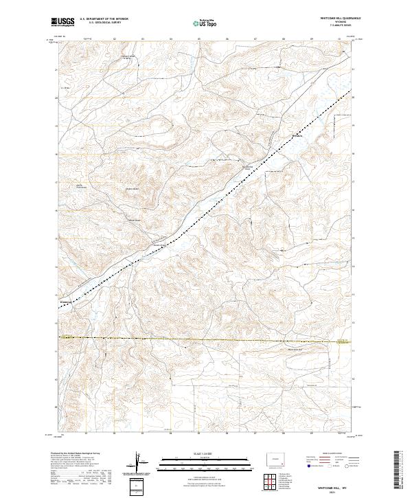
1962 Map of Whitcomb Hill
USGS Topo · Published 1986About this map
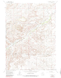
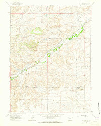
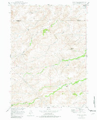
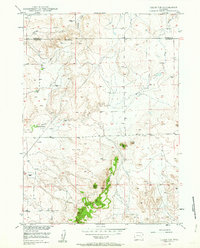
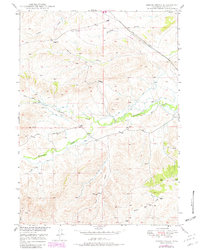
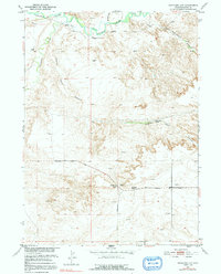
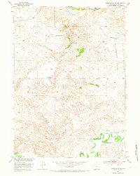
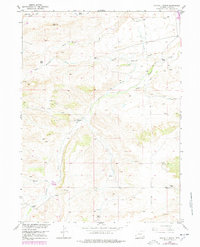
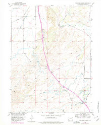
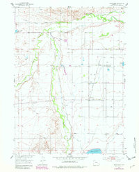
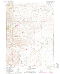
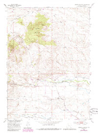
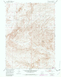
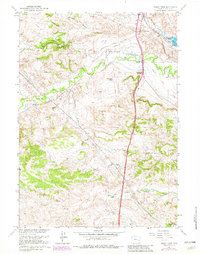
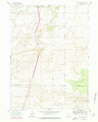
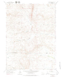
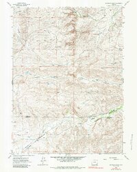
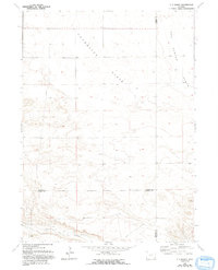
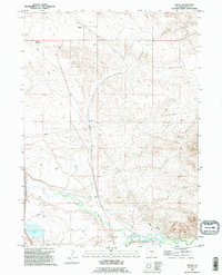
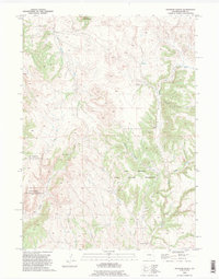
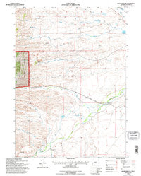
Chugwater Creek and its many tributaries, including North Fork Chugwater Creek and Spring Creek, carve through this high-elevation landscape on the border of Platte and Laramie Counties. The mid-century geography is defined by the Colorado and Southern railroad line, which follows the creek valley past the Whitcomb Hill ranching area and the locality of Brinton. In the more isolated western reaches, features like Desans Butte and several long drainage systems such as Mendenhal Draw and Desans Draw dominate the terrain. A single educational landmark, Chalk Hill Sch, appears in the southern portion of the sheet, providing a rare point of civic infrastructure in this ranch-heavy region. The map preserves the exact placement of early pipelines and ranch-related sites like Mendenhal at a time when the rural landscape remained largely unchanged from its early settlement patterns.
Find a feature on this map
17 named features on this map. Tap any name to fly to it.
Don’t see what you’re looking for? This feature index may not catch every label — zoom into the map to look around manually.
Map Details
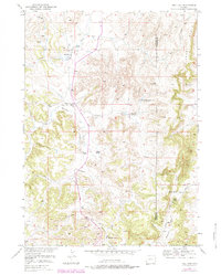
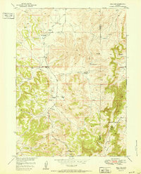
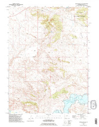
Editions of this 1962 Whitcomb Hill Map
2 editions found
Historical Maps of Laramie County Through Time
107 maps found
1949 Cedar Hill
Platte County, WY
1949 Cedar Top
Platte County, WY
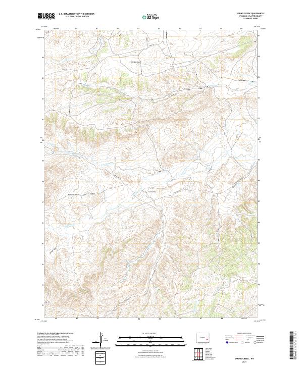
1949 Spring Creek
Platte County, WY

1950 Cedar Top
Platte County, WY
1950 Coleman Butte
Platte County, WY
1950 Cottonwood Falls
Platte County, WY
1950 Guernsey Reservoir
Platte County, WY
1950 Haushar Ranch
Platte County, WY
1950 Hell Gap
Platte County, WY
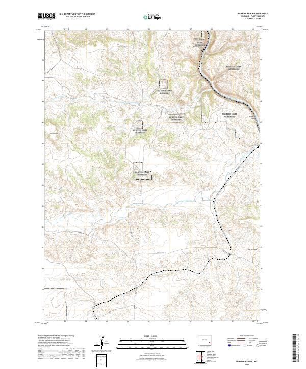
1950 Herman Ranch
Platte County, WY

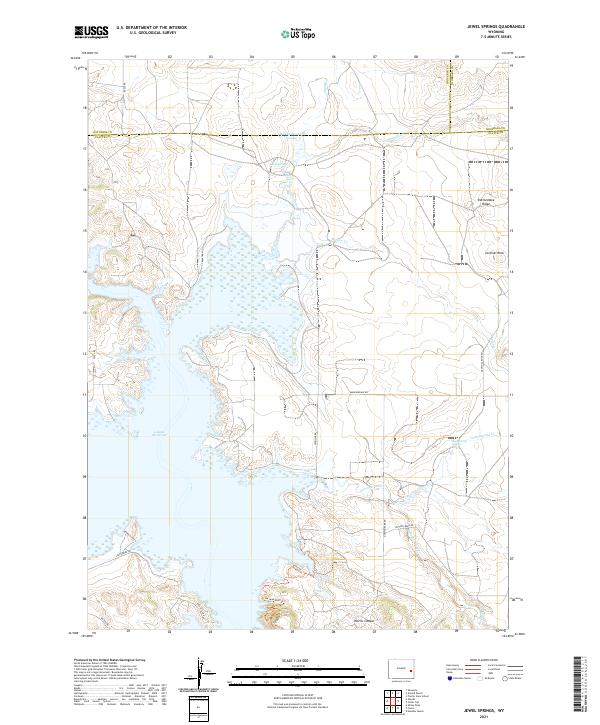
1950 Jewel Springs
Platte County, WY
1950 Register Cliff
Platte County, WY

1950 Spring Creek
Platte County, WY
1951 Antelope Gap
Platte County, WY
1951 Cedar Hill
Platte County, WY

1951 Coleman Butte
Platte County, WY

1951 Cottonwood Falls
Platte County, WY
1951 Dwyer
Platte County, WY
1951 Eagles Nest
Platte County, WY

1951 Guernsey Reservoir
Platte County, WY
1951 Haushar Ranch
Platte County, WY
1951 Hell Gap
Platte County, WY
1951 Herman Ranch
Platte County, WY
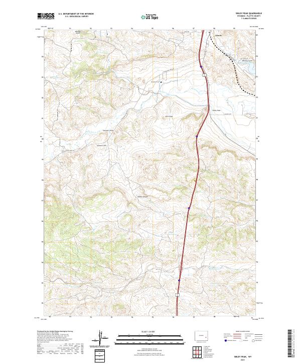
1951 Sibley Peak
Platte County, WY
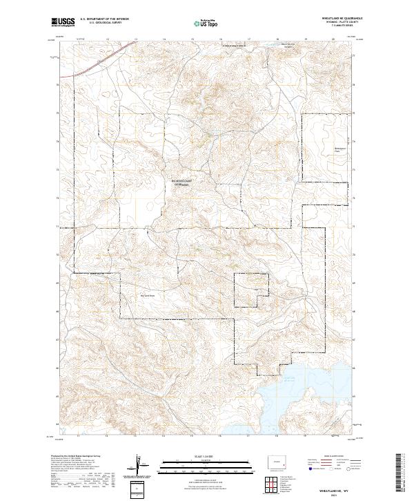
1951 Wheatland NE
Platte County, WY
1952 Cassa
Platte County, WY
1952 Register Cliff
Platte County, WY
1953 Bordeaux
Platte County, WY
1953 Double L Ranch
Platte County, WY
1953 Ferguson Corner
Platte County, WY
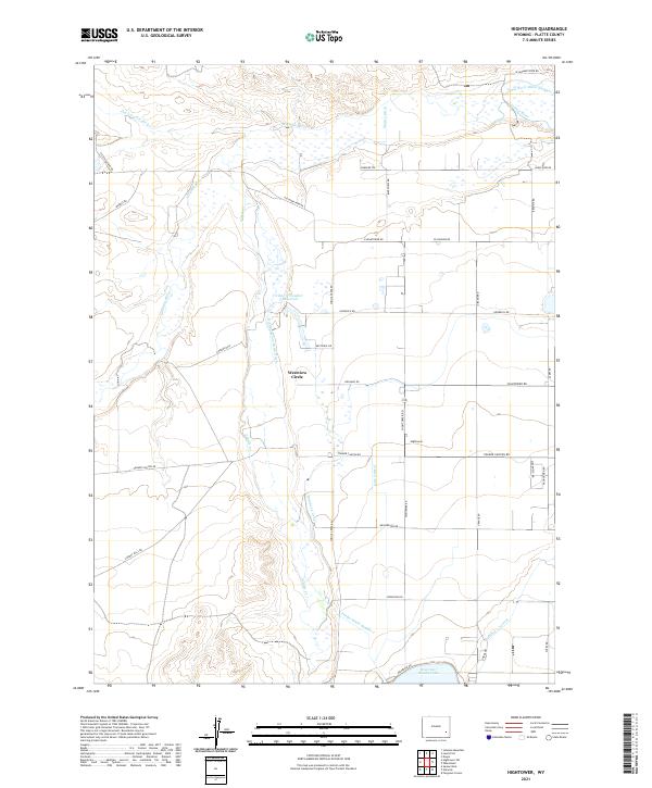
1953 Hightower
Platte County, WY
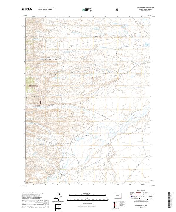
1953 Hightower SW
Platte County, WY
1953 Johnson Mountain
Platte County, WY
1953 Lewis Flat
Platte County, WY
1953 Natwick
Platte County, WY
1953 Natwick SW
Platte County, WY
1953 Richeau Hills
Platte County, WY
1953 Squaw Rock
Platte County, WY
1961 Cassa
Platte County, WY
1961 Jewel Springs
Platte County, WY
1961 Sibley Peak
Platte County, WY
1962 Bristol Ridge NE
Platte County, WY
1962 Delano Ranch
Platte County, WY
1962 Mc Donald Ranch
Platte County, WY
1962 Whitcomb Hill
Platte County, WY
1963 C S Ranch
Platte County, WY
1963 Dickinson Hill
Platte County, WY
1963 Klutz Canyon
Platte County, WY
1971 Guernsey Reservoir
Platte County, WY
1978 Meadowdale
Platte County, WY
1990 Antelope Gap
Platte County, WY
1990 Bordeaux
Platte County, WY
1990 Bristol Ridge NE
Platte County, WY
1990 Cassa
Platte County, WY
1990 C S Ranch
Platte County, WY
1990 Dickinson Hill
Platte County, WY
1990 Double L Ranch
Platte County, WY
1990 Dwyer
Platte County, WY
1990 Eagles Nest
Platte County, WY
1990 Ferguson Corner
Platte County, WY
1990 Guernsey Reservoir
Platte County, WY
1990 Haushar Ranch
Platte County, WY
1990 Hell Gap
Platte County, WY
1990 Herman Ranch
Platte County, WY
1990 Klutz Canyon
Platte County, WY
1990 Register Cliff
Platte County, WY
1990 Wheatland NE
Platte County, WY
1990 Whitcomb Hill
Platte County, WY
1992 Cottonwood Falls
Platte County, WY
1992 Hightower SW
Platte County, WY
1992 Johnson Mountain
Platte County, WY
2021 Antelope Gap
Platte County, WY
2021 Bordeaux
Platte County, WY
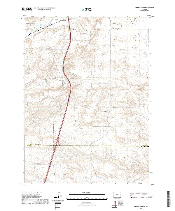
2021 Bristol Ridge NE
Platte County, WY
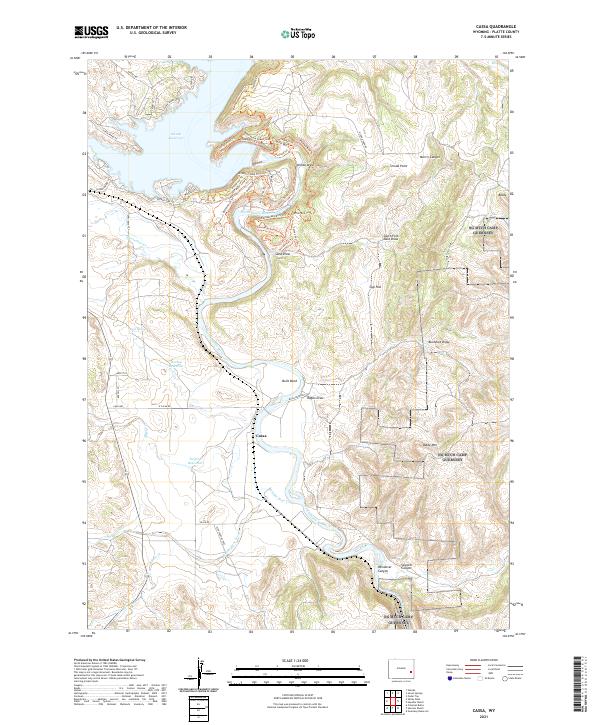
2021 Cassa
Platte County, WY
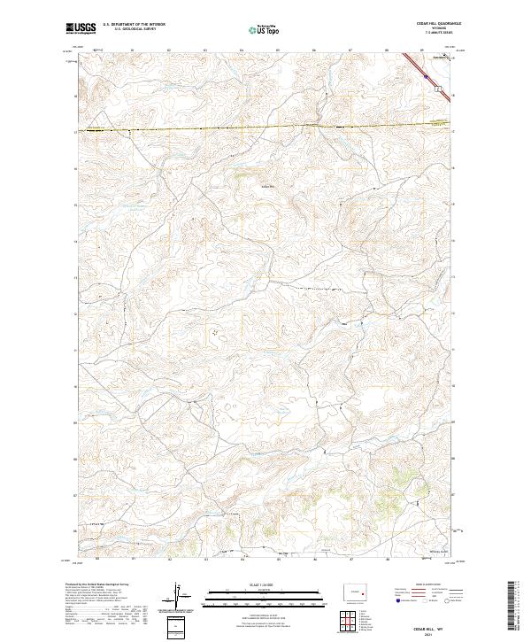
2021 Cedar Hill
Platte County, WY
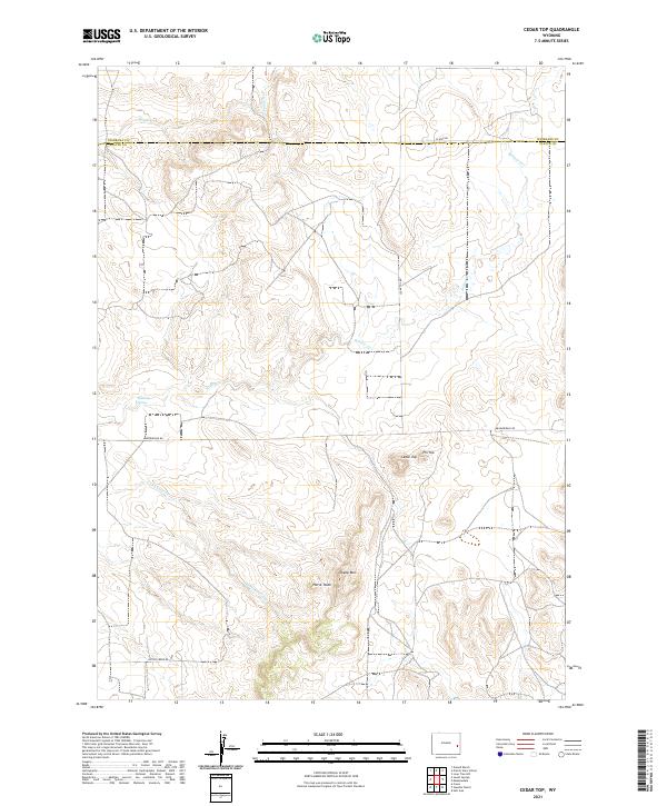
2021 Cedar Top
Platte County, WY
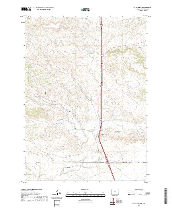
2021 Coleman Butte
Platte County, WY
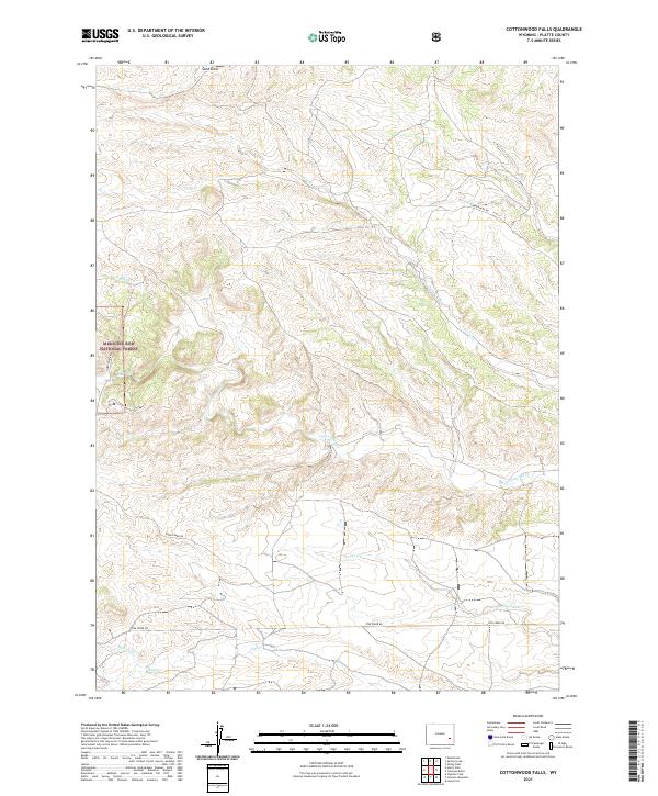
2021 Cottonwood Falls
Platte County, WY
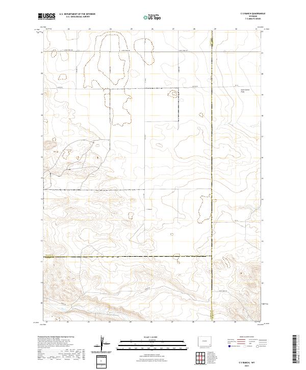
2021 C S Ranch
Platte County, WY
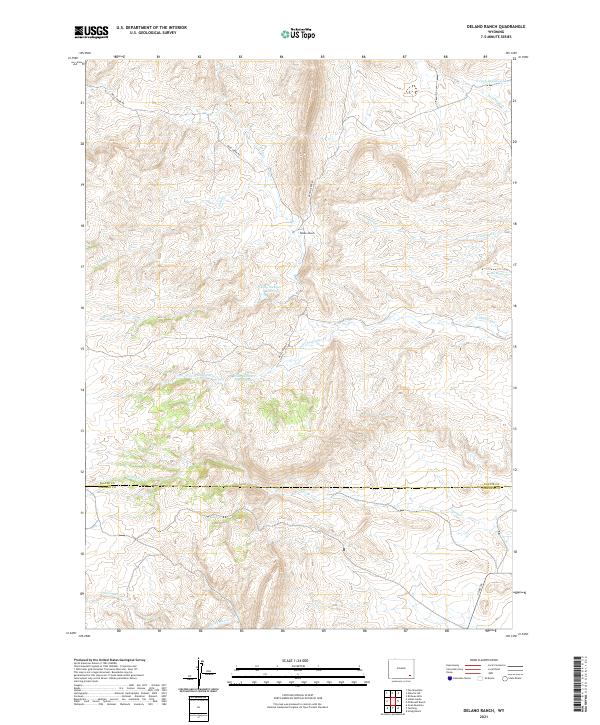
2021 Delano Ranch
Platte County, WY
2021 Dickinson Hill
Platte County, WY
2021 Double L Ranch
Platte County, WY
2021 Dwyer
Platte County, WY
2021 Eagles Nest
Platte County, WY
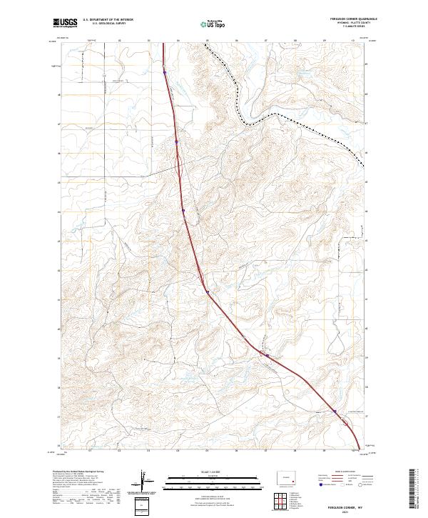
2021 Ferguson Corner
Platte County, WY
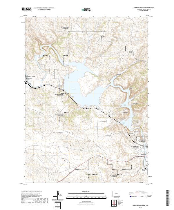
2021 Guernsey Reservoir
Platte County, WY
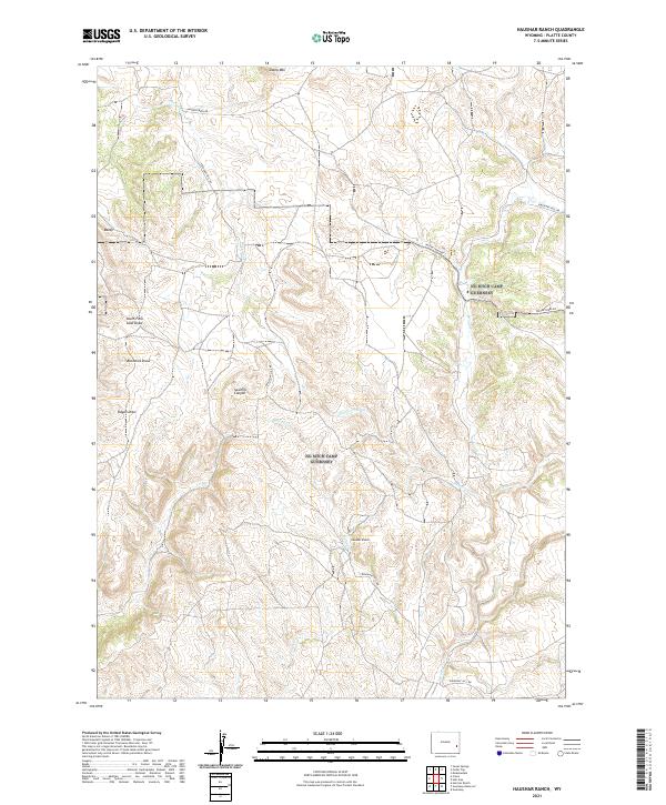
2021 Haushar Ranch
Platte County, WY
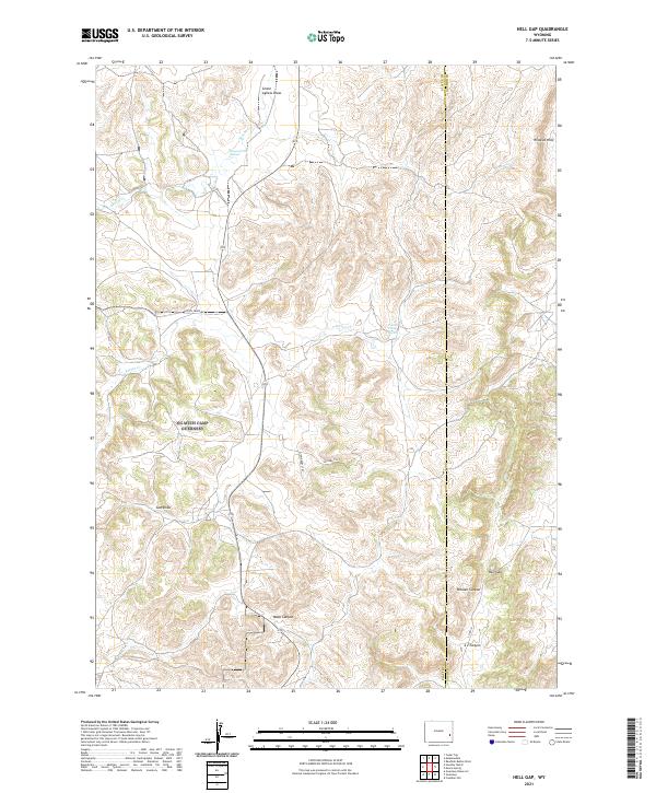
2021 Hell Gap
Platte County, WY
2021 Herman Ranch
Platte County, WY
2021 Hightower
Platte County, WY
2021 Hightower SW
Platte County, WY
2021 Jewel Springs
Platte County, WY
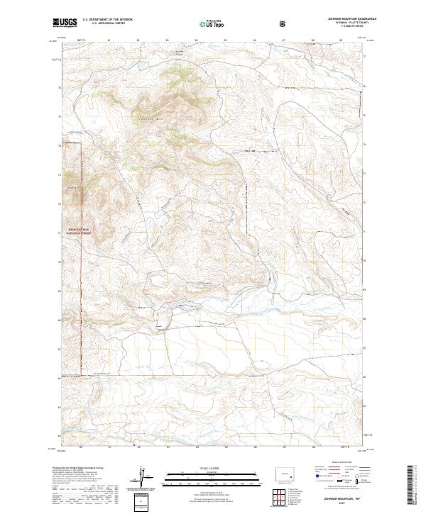
2021 Johnson Mountain
Platte County, WY
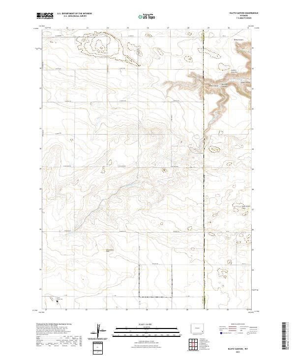
2021 Klutz Canyon
Platte County, WY
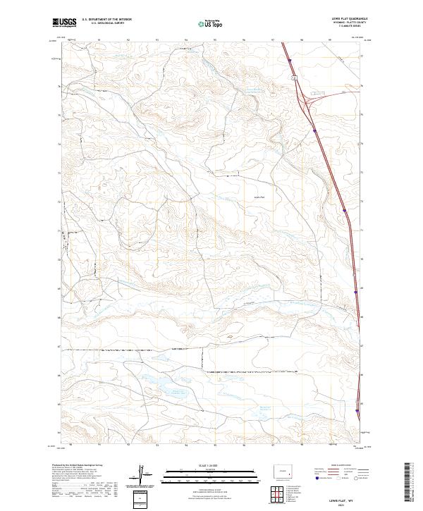
2021 Lewis Flat
Platte County, WY
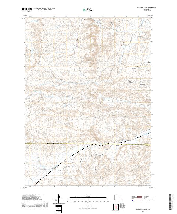
2021 McDonald Ranch
Platte County, WY
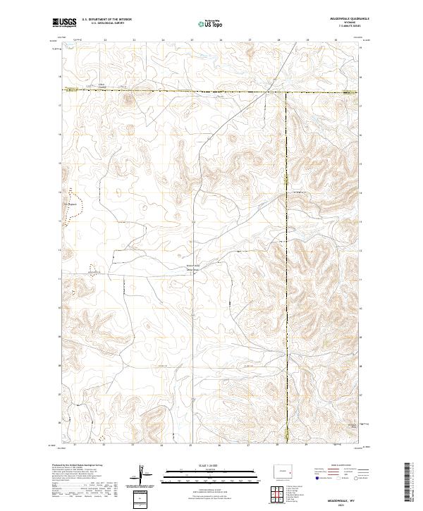
2021 Meadowdale
Platte County, WY
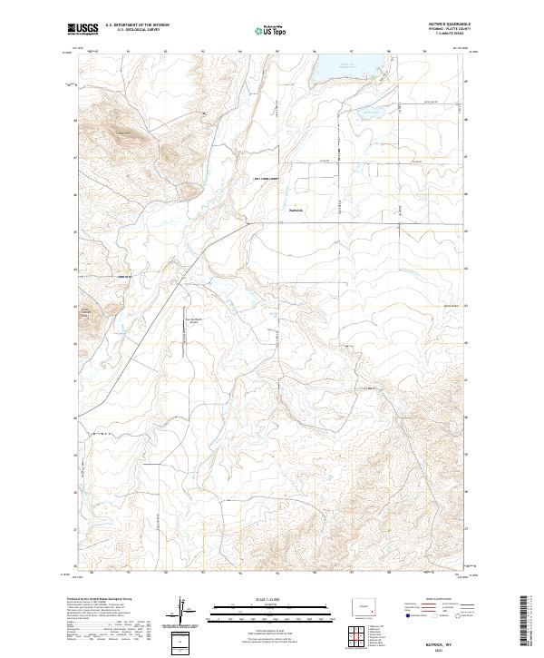
2021 Natwick
Platte County, WY
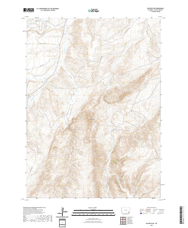
2021 Natwick SW
Platte County, WY
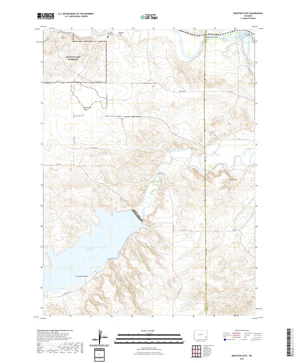
2021 Register Cliff
Platte County, WY
2021 Sibley Peak
Platte County, WY
2021 Spring Creek
Platte County, WY
2021 Wheatland NE
Platte County, WY
2021 Whitcomb Hill
Platte County, WY
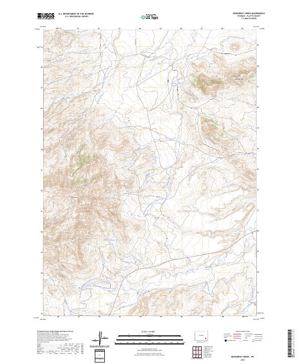
2023 McMurray Creek
Platte County, WY
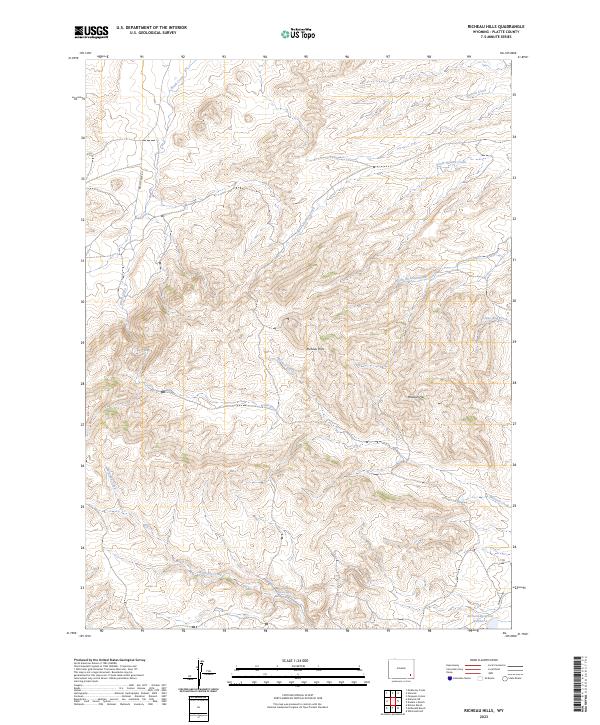
2023 Richeau Hills
Platte County, WY